MyTopo
Fingerboard Saddle Oregon US Topo Map
Couldn't load pickup availability
Also explore the Fingerboard Saddle Forest Service Topo of this same quad for updated USFS data
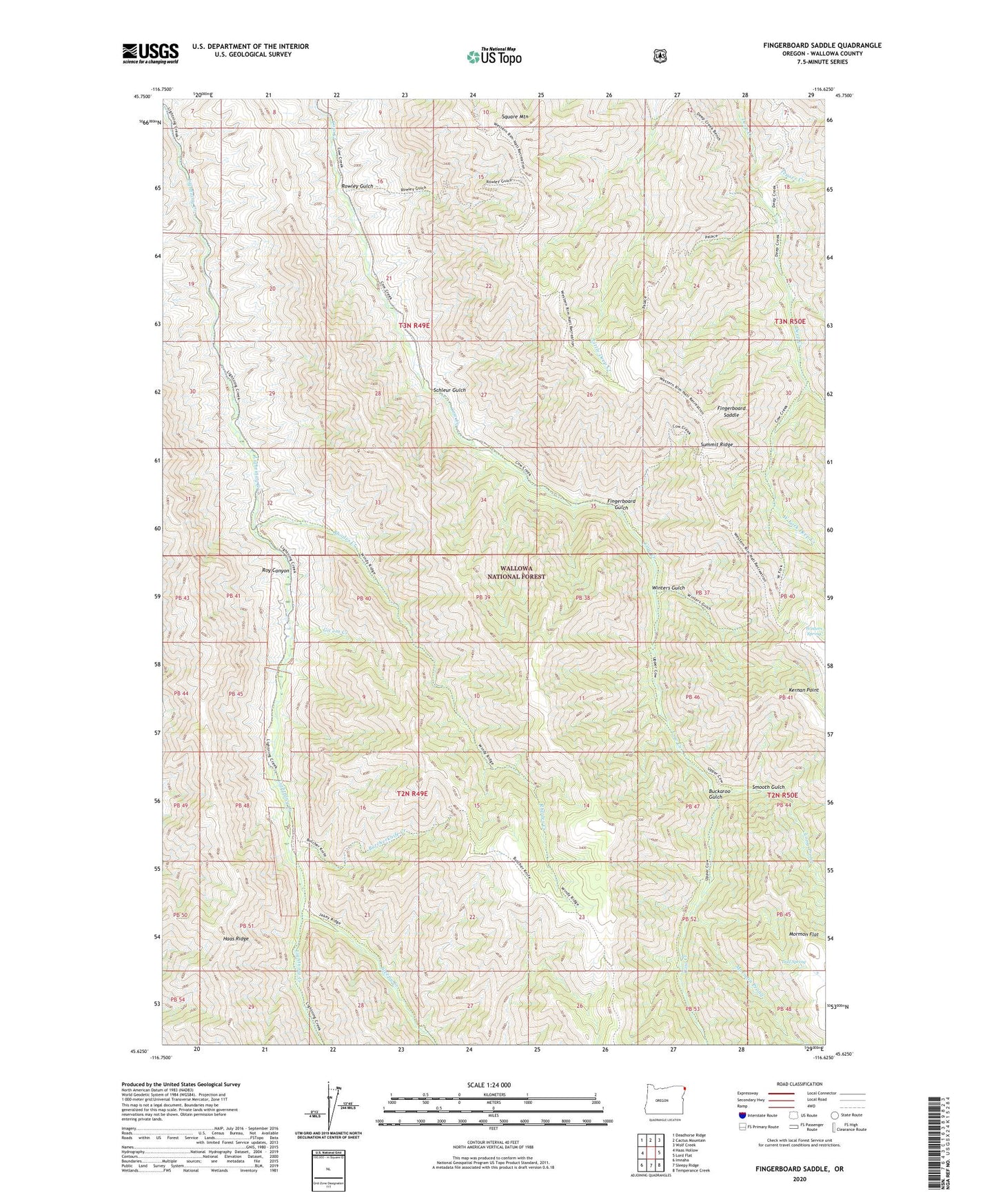
2024 topographic map quadrangle Fingerboard Saddle in the state of Oregon. Scale: 1:24000. Based on the newly updated USGS 7.5' US Topo map series, this map is in the following counties: Wallowa. The map contains contour data, water features, and other items you are used to seeing on USGS maps, but also has updated roads and other features. This is the next generation of topographic maps. Printed on high-quality waterproof paper with UV fade-resistant inks.
Quads adjacent to this one:
West: Haas Hollow
Northwest: Deadhorse Ridge
North: Cactus Mountain
Northeast: Wolf Creek
East: Lord Flat
Southeast: Temperance Creek
South: Sleepy Ridge
Southwest: Imnaha
This map covers the same area as the classic USGS quad with code o45116f6.
Contains the following named places: Buckaroo Gulch, Butcherknife Creek, Dad Spring, Fingerboard Gulch, Fingerboard Saddle, Git'em Creek, Kernan Point, Litch Ranch, Long Prong, Mormon Prong, Rhodes Creek, Rhodes Creek Ranch, Rowley Gulch, Roy Canyon, Schleur Gulch, Sleepy Creek, Smooth Gulch, Square Mountain, Teaser Creek, West Fork Deep Creek, Winters Gulch, Winters Spring