MyTopo
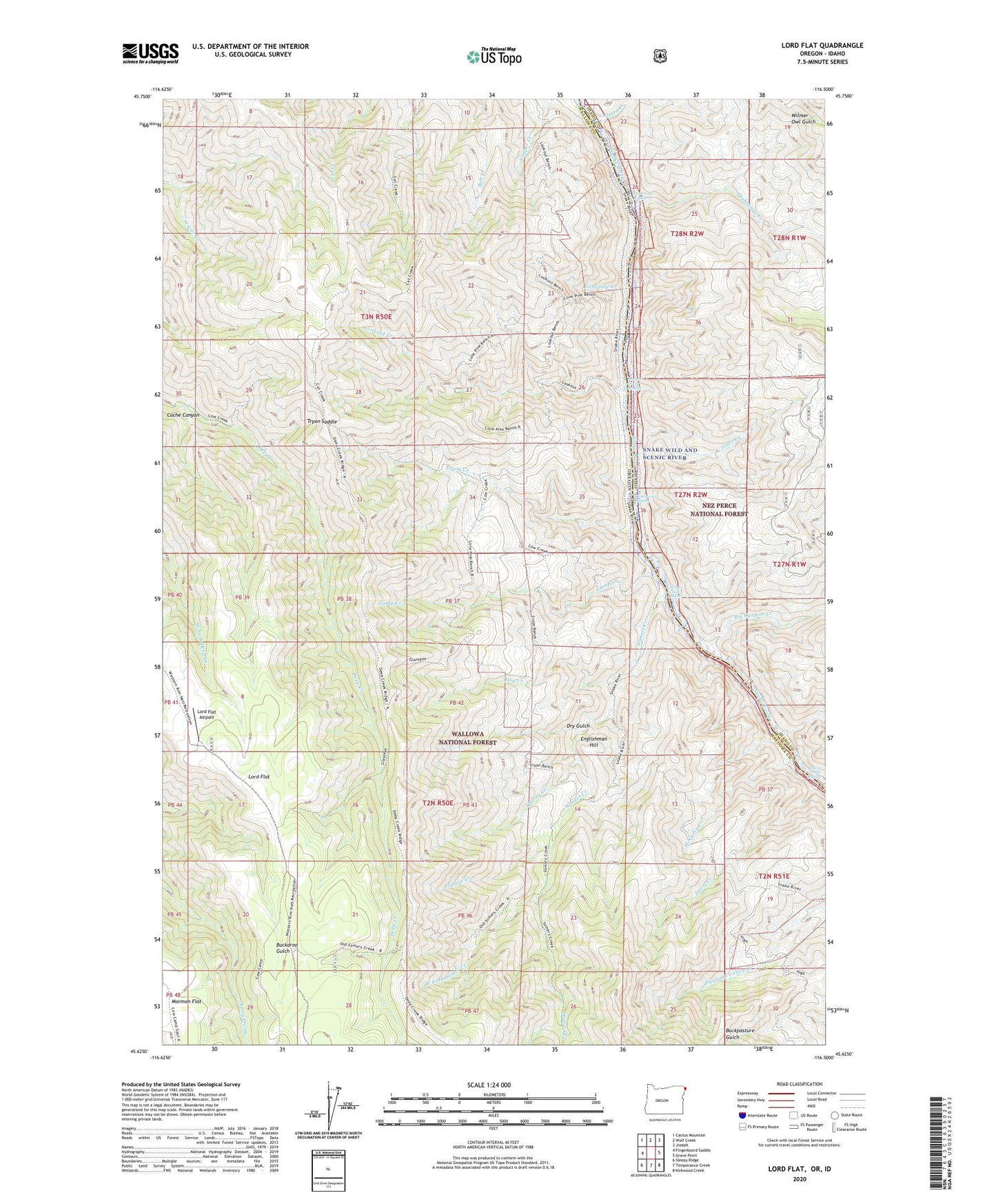
Lord Flat Oregon US Topo Map
Couldn't load pickup availability
Also explore the Lord Flat Forest Service Topo of this same quad for updated USFS data
2024 topographic map quadrangle Lord Flat in the states of Idaho, Oregon. Scale: 1:24000. Based on the newly updated USGS 7.5' US Topo map series, this map is in the following counties: Wallowa, Idaho. The map contains contour data, water features, and other items you are used to seeing on USGS maps, but also has updated roads and other features. This is the next generation of topographic maps. Printed on high-quality waterproof paper with UV fade-resistant inks.
Quads adjacent to this one:
West: Fingerboard Saddle
Northwest: Cactus Mountain
North: Wolf Creek
Northeast: Joseph
East: Grave Point
Southeast: Kirkwood Creek
South: Temperance Creek
Southwest: Sleepy Ridge
This map covers the same area as the classic USGS quad with code o45116f5.
Contains the following named places: Big Canyon Creek, Cache Canyon, Camp Creek, Copper Creek Lodge, Cottonwood Rapids, Cougar Creek, Davis Creek, Davis Creek Rapids, Dorrance Cow Camp, Dry Gulch, Englishman Hill, Getta Creek, Highrange Creek, Highrange Rapids, Hog Creek, Jones Creek, Lonepine Creek, Lookout Creek, Lookout Creek Rapids, Lord Flat, Lord Flat Airport, McCarty Creek, Mormon Flat, Somers Creek, Somers Creek Rapids, Somers Ranch, Thorny Creek, Tryon Creek, Tryon Creek Ranch, Tryon Saddle, West Fork Somer Creek