MyTopo
Haas Hollow Oregon US Topo Map
Couldn't load pickup availability
Also explore the Haas Hollow Forest Service Topo of this same quad for updated USFS data
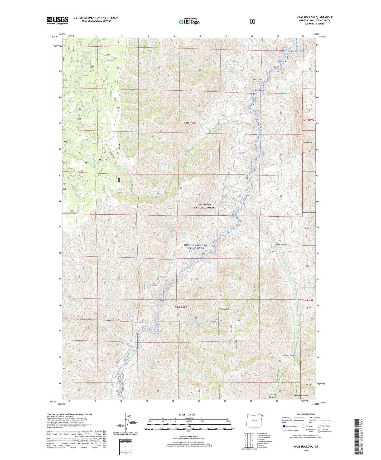
2023 topographic map quadrangle Haas Hollow in the state of Oregon. Scale: 1:24000. Based on the newly updated USGS 7.5' US Topo map series, this map is in the following counties: Wallowa. The map contains contour data, water features, and other items you are used to seeing on USGS maps, but also has updated roads and other features. This is the next generation of topographic maps. Printed on high-quality waterproof paper with UV fade-resistant inks.
Quads adjacent to this one:
West: Zumwalt
Northwest: Poison Point
North: Deadhorse Ridge
Northeast: Cactus Mountain
East: Fingerboard Saddle
Southeast: Sleepy Ridge
South: Imnaha
Southwest: Findley Buttes
This map covers the same area as the classic USGS quad with code o45116f7.
Contains the following named places: Austin Ranch, Basin Creek, Berland Ranch, Buck Creek, Corral Creek, Corral Creek Ranch, Cottonwood Creek, Dodson Fork, Dry Lake Fork, East Fork Fence Creek, Fall Creek, Fence Creek, Haas Hollow, Horse Creek, Kettle Creek, Knapper Gulch, Little Basin Creek, Log Creek, North Fork Basin Creek, Packsaddle Creek, Packsaddle Spring, Pileup Canyon, Pumpkin Creek, Simmons Ranch, Stubblefield Fork, Thorn Creek, Thorn Creek Guard Station, Tulley Creek