MyTopo
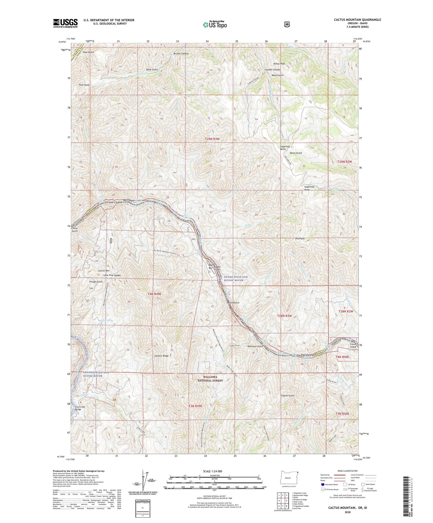
Cactus Mountain Oregon US Topo Map
Couldn't load pickup availability
Also explore the Cactus Mountain Forest Service Topo of this same quad for updated USFS data
2023 topographic map quadrangle Cactus Mountain in the states of Idaho, Oregon. Scale: 1:24000. Based on the newly updated USGS 7.5' US Topo map series, this map is in the following counties: Wallowa, Idaho, Nez Perce. The map contains contour data, water features, and other items you are used to seeing on USGS maps, but also has updated roads and other features. This is the next generation of topographic maps. Printed on high-quality waterproof paper with UV fade-resistant inks.
Quads adjacent to this one:
West: Deadhorse Ridge
Northwest: Wapshilla Creek
North: Rattlesnake Ridge
Northeast: Boles
East: Wolf Creek
Southeast: Lord Flat
South: Fingerboard Saddle
Southwest: Haas Hollow
This map covers the same area as the classic USGS quad with code o45116g6.
Contains the following named places: Big Canyon, Big Sulphur Creek, Big Sulphur Rapids, Birch Creek, Boulder Rapids, Brushy Canyon, Cactus Mountain, Camp Creek, Canaan Canyon, China Creek, China Gulch, Chinese Massacre Cove, Cow Creek Bridge, Coyote Gulch, Deep Creek, Deep Creek Rapids, Dellas Peak, Divide Creek, Divide Creek Rapids, Dog Creek, Doug Creek, Dry Creek Island, Dry Point, Dug Bar, Dug Bar Airport, Dug Bar Boat Ramp, Dug Bar Recreation Site, Dug Creek, Dug Creek Rapids, Fence Gulch, Kane Gulch, Little Deep Creek, Little Sulphur Creek, Lone Pine Saddle, Lower Dug Bar Rapids, Mack Gulch, Pool Gulch, Pool Knob, Robinson Gulch, Robinson Gulch Rapids, Spencer Ranch, Spencer Ranch Landing Strip, Sugarloaf Butte, Sugarloaf Knob, Thorn Spring Creek, Trail Gulch, Warm Springs Rapids, Whitehorse Rapids, Willow Spring, Wyley Creek, Zigzag Creek, Zigzag Rapids