MyTopo
Fitzwater Point Oregon US Topo Map
Couldn't load pickup availability
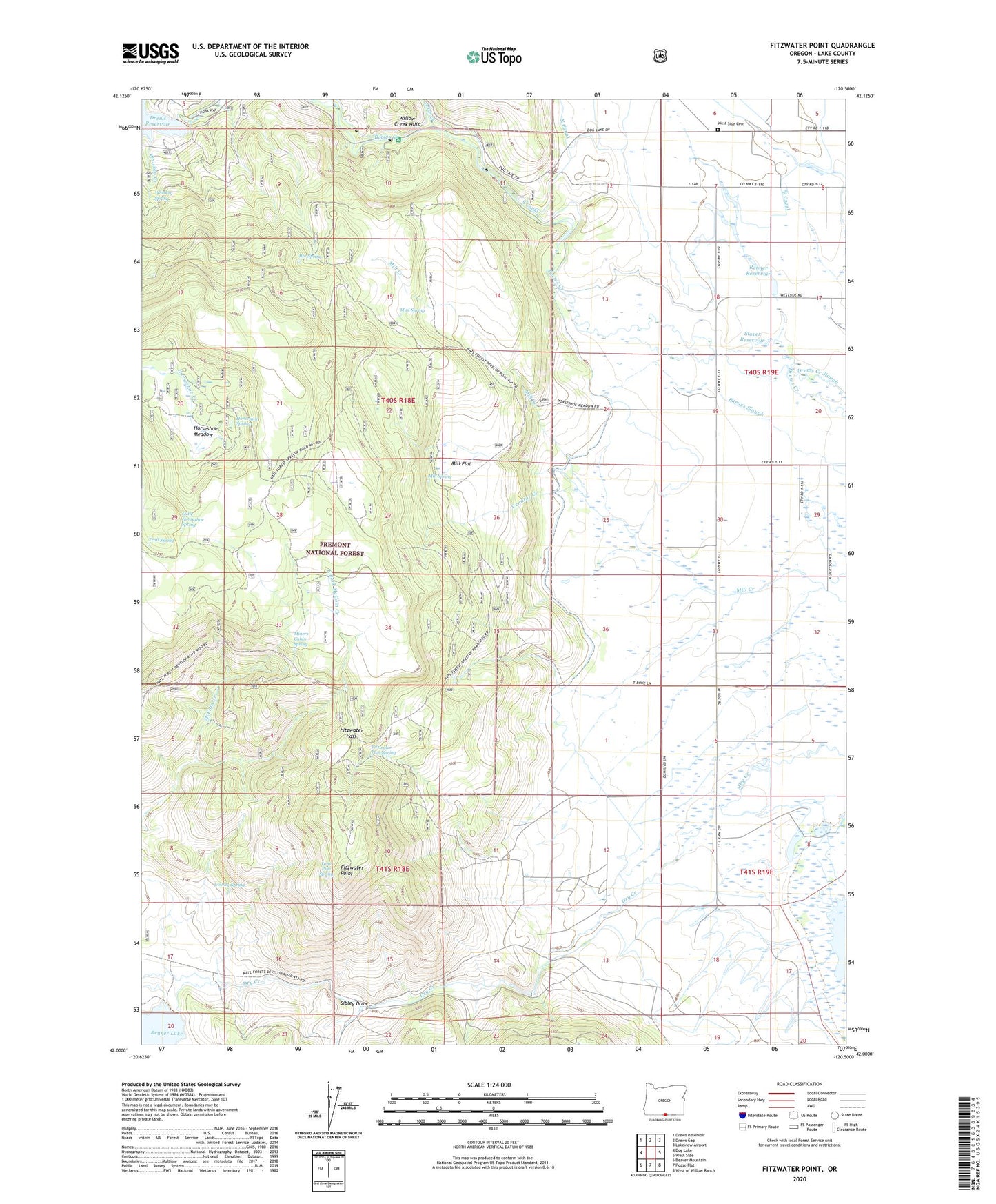
2020 topographic map quadrangle Fitzwater Point in the state of Oregon. Scale: 1:24000. Based on the newly updated USGS 7.5' US Topo map series, this map is in the following counties: Lake. The map contains contour data, water features, and other items you are used to seeing on USGS maps, but also has updated roads and other features. This is the next generation of topographic maps. Printed on high-quality waterproof paper with UV fade-resistant inks.
Quads adjacent to this one:
West: Dog Lake
Northwest: Drews Reservoir
North: Drews Gap
Northeast: Lakeview Airport
East: West Side
Southeast: West of Willow Ranch
South: Pease Flat
Southwest: Beaver Mountain
Contains the following named places: Ashcraft Flume, Ashcraft Ranch, Becraft Ranch, Bee Spring, Behm Ranch, Briggs Ranch, County Spring, Drews Creek Recreation Site, Drews Dam, Drews Reservoir Boat Ramp, Drews Reservoir County Park, East Canal, East Fork McCoin Creek, Fish Creek, Fitzwater Pass, Fitzwater Pass Spring, Fitzwater Point, Friday Ranch, Goose Lake Timber Camp, Horseshoe Meadow, Horseshoe Spring, Juniper Post Office, Lakeview Water Users Headquarters, Little Horseshoe Spring, Lone Pine Spring, Mill Flat, Mill Spring, Miners Cabin Spring, Mud Spring, Renner Dam, Renner Ranch, Renner Reservoir, Sibley Draw, South Canal, Stover Reservoir, Theora Post Office, Trail Spring, Venator Creek, West Side Cemetery, Whiskey Creek, Whiskey Spring