MyTopo
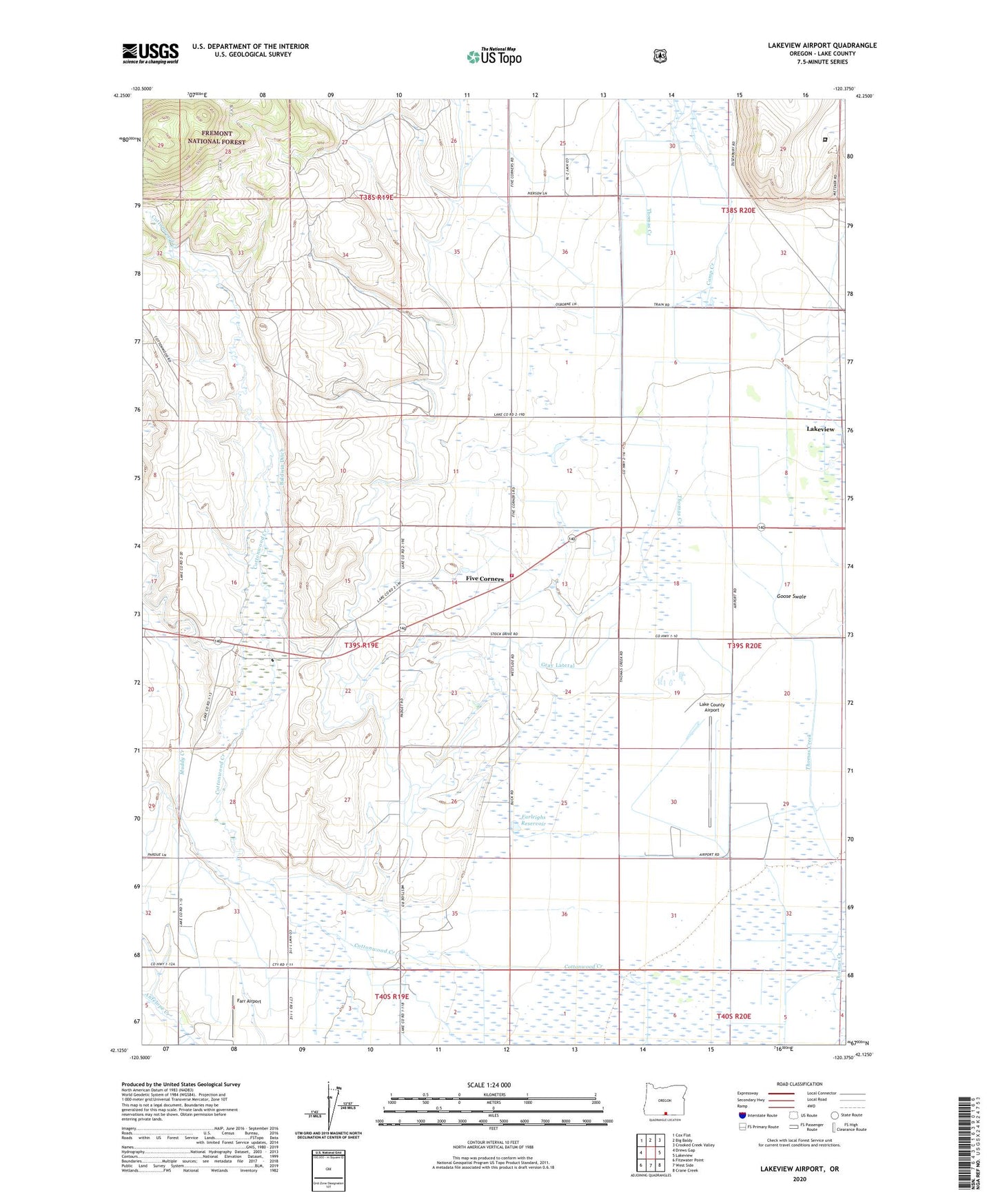
Lakeview Airport Oregon US Topo Map
Couldn't load pickup availability
Also explore the Lakeview Airport Forest Service Topo of this same quad for updated USFS data
2024 topographic map quadrangle Lakeview Airport in the state of Oregon. Scale: 1:24000. Based on the newly updated USGS 7.5' US Topo map series, this map is in the following counties: Lake. The map contains contour data, water features, and other items you are used to seeing on USGS maps, but also has updated roads and other features. This is the next generation of topographic maps. Printed on high-quality waterproof paper with UV fade-resistant inks.
Quads adjacent to this one:
West: Drews Gap
Northwest: Cox Flat
North: Big Baldy
Northeast: Crooked Creek Valley
East: Lakeview
Southeast: Crane Creek
South: West Side
Southwest: Fitzwater Point
This map covers the same area as the classic USGS quad with code o42120b4.
Contains the following named places: Baldwin Ditch, Bullard Creek, Camp Creek, Cottonwood Post Office, East Branch Thomas Creek, Farleighs Reservoir, Farr Airport, Five Corners, Goose Swale, Gray Lateral, Lake County Airport, Lakeview Dragstrip, Leehmann Ranch, Mark Clark Golf Course, Muddy Creek, New Idaho, New Idaho School, Reed Ranch, Roberts Ranch, Thomas Creek Rural Fire Department, Vernon School, Warner Creek, Warner Creek Correctional Facility