MyTopo
Flowers Gulch Oregon US Topo Map
Couldn't load pickup availability
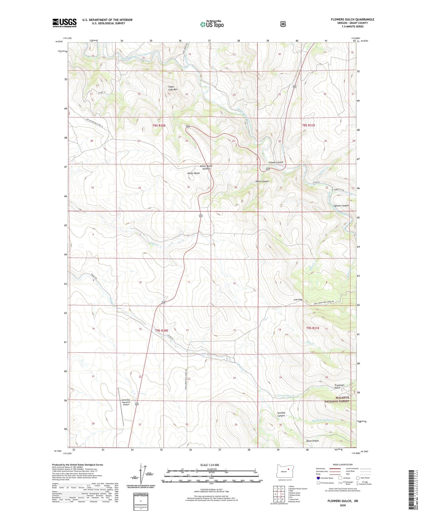
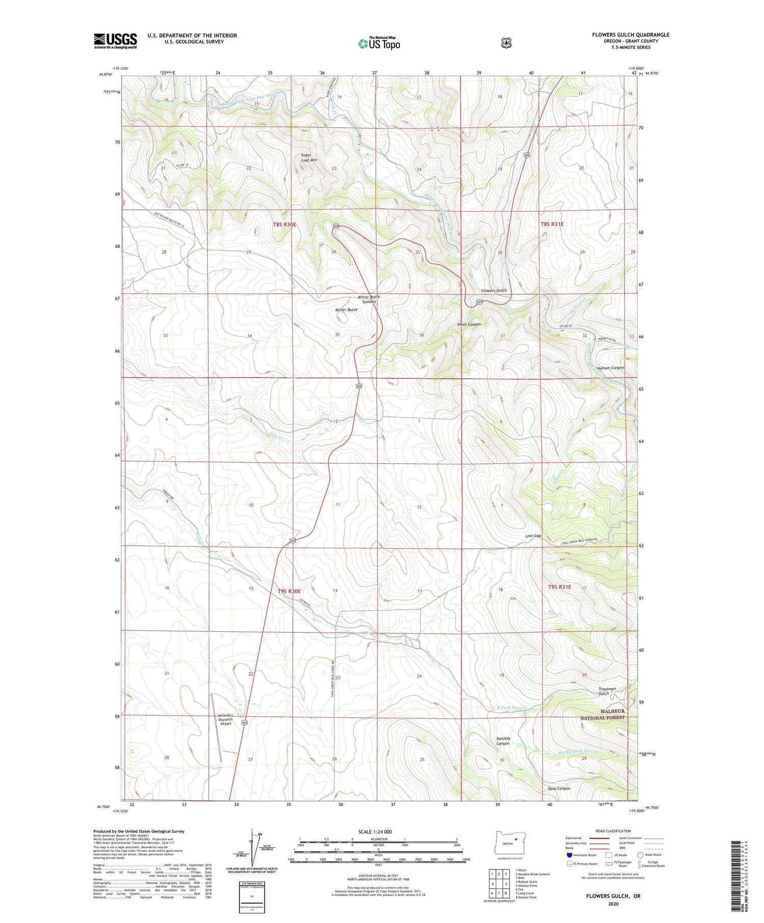
2020 topographic map quadrangle Flowers Gulch in the state of Oregon. Scale: 1:24000. Based on the newly updated USGS 7.5' US Topo map series, this map is in the following counties: Grant. The map contains contour data, water features, and other items you are used to seeing on USGS maps, but also has updated roads and other features. This is the next generation of topographic maps. Printed on high-quality waterproof paper with UV fade-resistant inks.
Quads adjacent to this one:
West: Bullock Gulch
Northwest: Ritter
North: Meadow Brook Summit
Northeast: Dale
East: Wildcat Point
Southeast: Keeney Point
South: Long Creek
Southwest: Fox
Contains the following named places: Caverhill, Caverhill Post Office, Dale Canyon, Elliot Creek, Flowers Gulch, Granite Creek, Hanson Canyon, Lick Creek, Low Gap, Middle Fork John Day River Rest Area, Middle Fork Pass Creek, Miranda's Skyranch Airport, North Fork Pass Creek, Plant Canyon, Range School, Ritter Butte, Ritter Butte Summit, Rush Creek, Sugar Loaf Mountain, Swickey Canyon, Troutman Gulch, Willow Creek