MyTopo
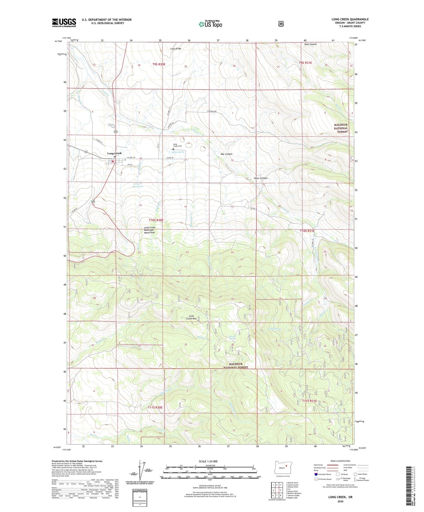
Long Creek Oregon US Topo Map
Couldn't load pickup availability
Also explore the Long Creek Forest Service Topo of this same quad for updated USFS data
2023 topographic map quadrangle Long Creek in the state of Oregon. Scale: 1:24000. Based on the newly updated USGS 7.5' US Topo map series, this map is in the following counties: Grant. The map contains contour data, water features, and other items you are used to seeing on USGS maps, but also has updated roads and other features. This is the next generation of topographic maps. Printed on high-quality waterproof paper with UV fade-resistant inks.
Quads adjacent to this one:
West: Fox
Northwest: Bullock Gulch
North: Flowers Gulch
Northeast: Wildcat Point
East: Keeney Point
Southeast: Magone Lake
South: Johnson Saddle
Southwest: Belshaw Meadows
This map covers the same area as the classic USGS quad with code o44119f1.
Contains the following named places: Alder Brook, Bingville Creek, Bly Creek, Carter Park Safety Rest Area, City of Long Creek, Coles Bridge, Dunning Creek, Everett Creek, Gander Creek, Harer Canyon, Jordan Creek, Lantern Spring, LC Mountain Translator Site, Long Creek, Long Creek Cemetery, Long Creek City Hall, Long Creek Fire Department, Long Creek Mountain, Long Creek Municipal Watershed, Long Creek Post Office, Long Creek Public Works Department Office, Long Creek Reservoir, Long Creek School, Long Creek Wastewater Treatment Facility, Mill Creek, Murphy Creek, Paul Creek, Pole Creek, Shaw Creek, South Fork Long Creek, Spring Creek, War Canyon, Willow Spring