MyTopo
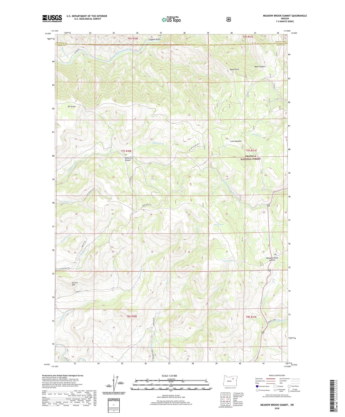
Meadow Brook Summit Oregon US Topo Map
Couldn't load pickup availability
Also explore the Meadow Brook Summit Forest Service Topo of this same quad for updated USFS data
2023 topographic map quadrangle Meadow Brook Summit in the state of Oregon. Scale: 1:24000. Based on the newly updated USGS 7.5' US Topo map series, this map is in the following counties: Grant, Umatilla. The map contains contour data, water features, and other items you are used to seeing on USGS maps, but also has updated roads and other features. This is the next generation of topographic maps. Printed on high-quality waterproof paper with UV fade-resistant inks.
Quads adjacent to this one:
West: Ritter
Northwest: Thompson Flat
North: Deerhorn Creek
Northeast: Bridge Creek
East: Dale
Southeast: Wildcat Point
South: Flowers Gulch
Southwest: Bullock Gulch
This map covers the same area as the classic USGS quad with code o44119h1.
Contains the following named places: Barnes Creek, Bone Point, Buckaroo Creek, Elk Grove, Gilson Creek, Gilson Pond, Litch Meadow, Meadow Brook Summit, Rush Pond, Saint Katherine Catholic Church, Shivers Rim, Sulphur Gulch, Tamarack Canyon, Walker