MyTopo
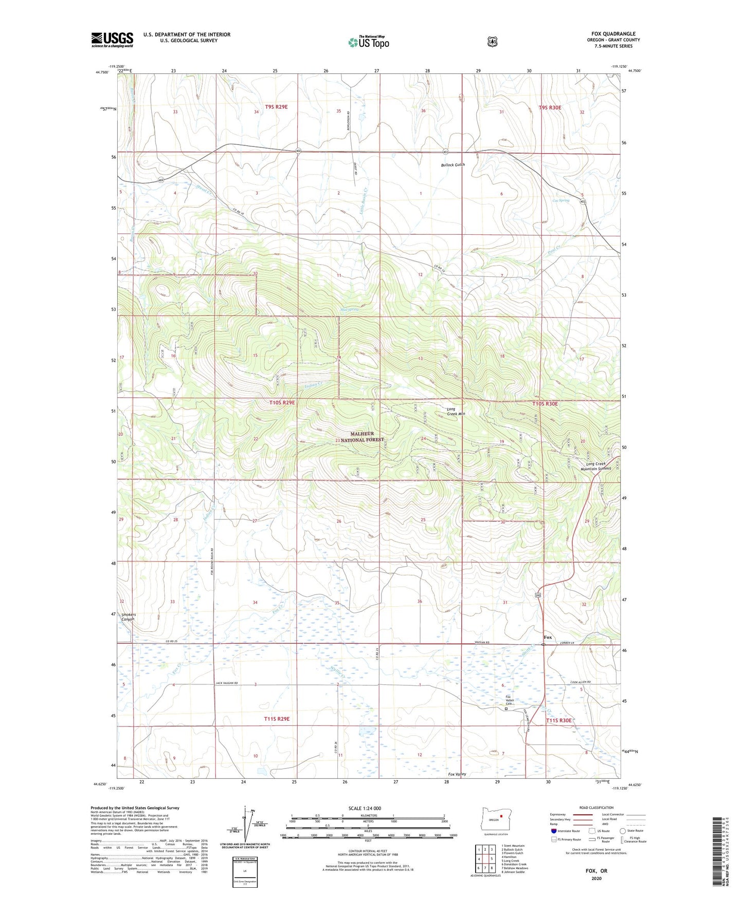
Fox Oregon US Topo Map
Couldn't load pickup availability
Also explore the Fox Forest Service Topo of this same quad for updated USFS data
2023 topographic map quadrangle Fox in the state of Oregon. Scale: 1:24000. Based on the newly updated USGS 7.5' US Topo map series, this map is in the following counties: Grant. The map contains contour data, water features, and other items you are used to seeing on USGS maps, but also has updated roads and other features. This is the next generation of topographic maps. Printed on high-quality waterproof paper with UV fade-resistant inks.
Quads adjacent to this one:
West: Hamilton
Northwest: Steet Mountain
North: Bullock Gulch
Northeast: Flowers Gulch
East: Long Creek
Southeast: Johnson Saddle
South: Belshaw Meadows
Southwest: Donaldson Creek
This map covers the same area as the classic USGS quad with code o44119f2.
Contains the following named places: Coe Spring, Fox, Fox Mill, Fox Post Office, Fox Valley Cemetery, Indian Creek, Long Creek Mountain Summit, Mud Spring, Round Basin School, Smith Creek, Smokers Canyon, Stussi Creek, Trester Post Office, Waterbury Mill, Wyllie Creek