MyTopo
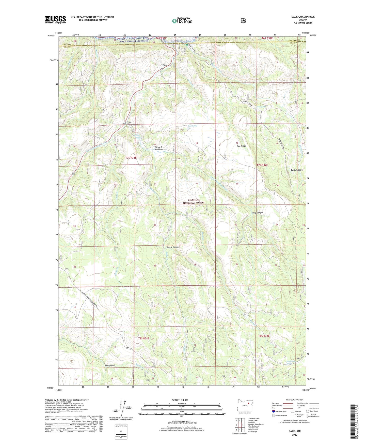
Dale Oregon US Topo Map
Couldn't load pickup availability
Also explore the Dale Forest Service Topo of this same quad for updated USFS data
2023 topographic map quadrangle Dale in the state of Oregon. Scale: 1:24000. Based on the newly updated USGS 7.5' US Topo map series, this map is in the following counties: Grant, Umatilla. The map contains contour data, water features, and other items you are used to seeing on USGS maps, but also has updated roads and other features. This is the next generation of topographic maps. Printed on high-quality waterproof paper with UV fade-resistant inks.
Quads adjacent to this one:
West: Meadow Brook Summit
Northwest: Deerhorn Creek
North: Bridge Creek
Northeast: Ukiah SE
East: The Cockscomb
Southeast: Sharp Ridge
South: Wildcat Point
Southwest: Flowers Gulch
This map covers the same area as the classic USGS quad with code o44118h8.
Contains the following named places: Board Gulch, Brush Creek, Bully Creek, Case Place, Case Ridge, Case Spring, Dale, Dale Post Office, Dale Ranger Station, Dale Work Center, Deep Canyon, Desolation Creek, Duff Meadows, East Fork Meadow Brook, George Hinton Ranch, Hinton Creek, Howard Meadows, Knapp Ranch, Meadow Brooks Falls, Moonshine Creek, Range, Range Post Office, Road Camp Spring, Smith Creek, Snake Creek, Spring Canyon, Toll Bridge Recreation Site, Twin Spring, West Fork Meadow Brook