MyTopo
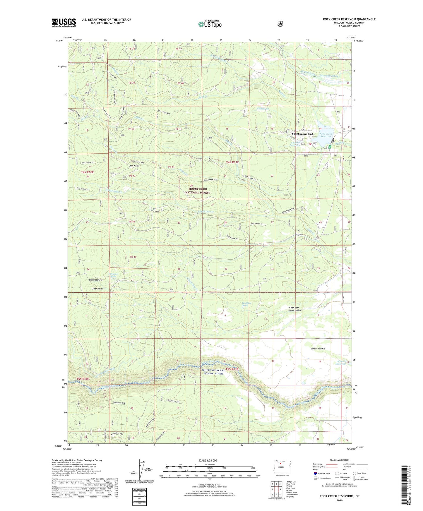
Rock Creek Reservoir Oregon US Topo Map
Couldn't load pickup availability
Also explore the Rock Creek Reservoir Forest Service Topo of this same quad for updated USFS data
2023 topographic map quadrangle Rock Creek Reservoir in the state of Oregon. Scale: 1:24000. Based on the newly updated USGS 7.5' US Topo map series, this map is in the following counties: Wasco. The map contains contour data, water features, and other items you are used to seeing on USGS maps, but also has updated roads and other features. This is the next generation of topographic maps. Printed on high-quality waterproof paper with UV fade-resistant inks.
Quads adjacent to this one:
West: Post Point
Northwest: Badger Lake
North: Flag Point
Northeast: Friend
East: Wamic
Southeast: Wapinitia
South: Foreman Point
Southwest: Beaver Butte
This map covers the same area as the classic USGS quad with code o45121b4.
Contains the following named places: Bus Point, Camp Cody, Clear Point, Immigrant Spring, Lost Boulder Ditch, Lower White River Wilderness, Miller Reservoir, North Fork Gate Creek, North Fork Hazel Hollow, North Fork Rock Creek, Pine Hollow Volunteer Fire Department Station 2, Pup Creek, Rock Creek Campground, Rock Creek Campground Boat Ramp, Rock Creek Dam, Rock Creek Guard Station, Rock Creek Reservoir, Rock Creek Reservoir Work Center, Smarts Reservoir, South Fork Gate Creek, Souva Creek, Sportsmans Park, Sportsmans Park Census Designated Place, Wamic Elementary School, Washburn Spring, White Wild and Scenic River, Wildcat Creek