MyTopo
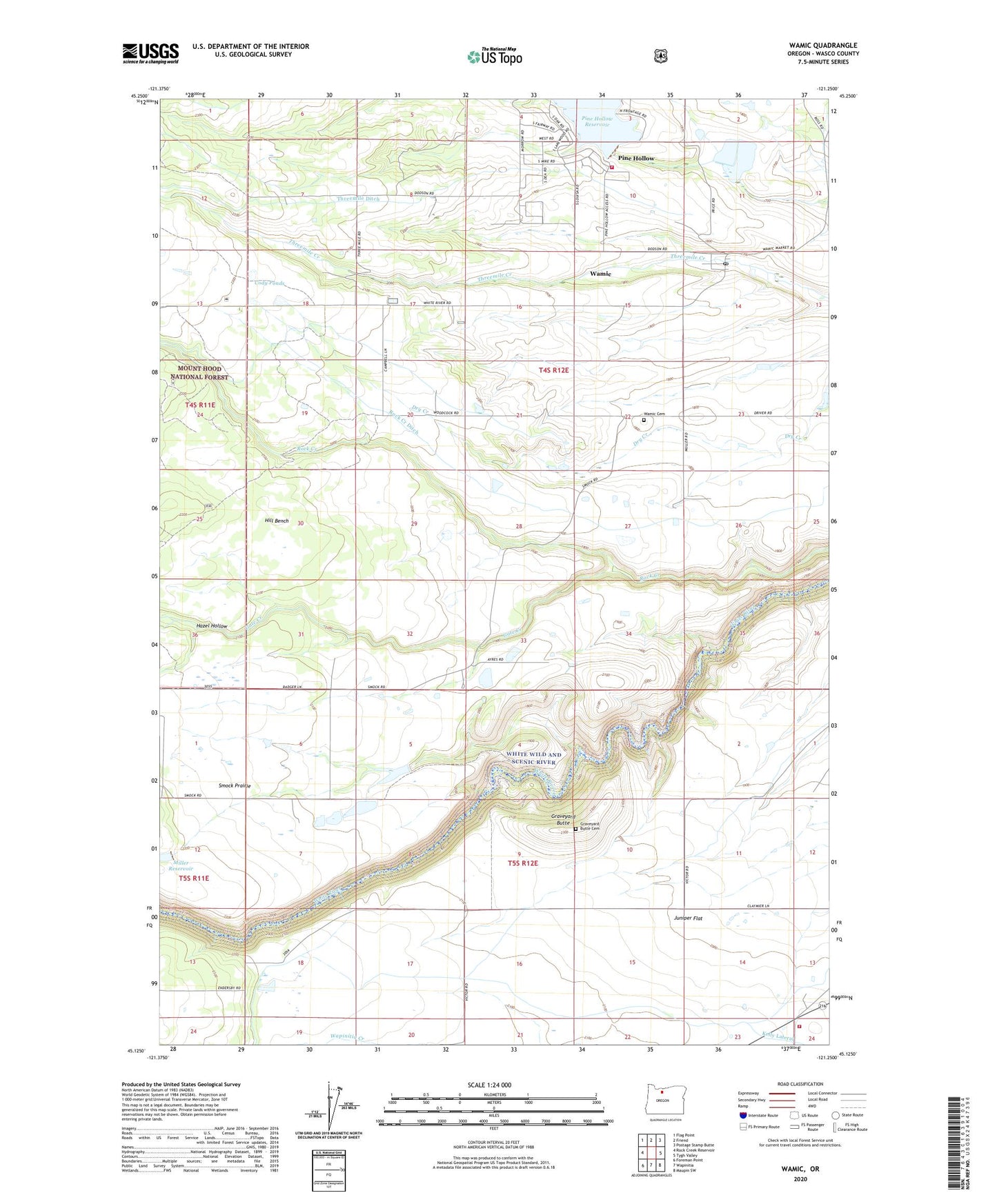
Wamic Oregon US Topo Map
Couldn't load pickup availability
Also explore the Wamic Forest Service Topo of this same quad for updated USFS data
2023 topographic map quadrangle Wamic in the state of Oregon. Scale: 1:24000. Based on the newly updated USGS 7.5' US Topo map series, this map is in the following counties: Wasco. The map contains contour data, water features, and other items you are used to seeing on USGS maps, but also has updated roads and other features. This is the next generation of topographic maps. Printed on high-quality waterproof paper with UV fade-resistant inks.
Quads adjacent to this one:
West: Rock Creek Reservoir
Northwest: Flag Point
North: Friend
Northeast: Postage Stamp Butte
East: Tygh Valley
Southeast: Maupin SW
South: Wapinitia
Southwest: Foreman Point
This map covers the same area as the classic USGS quad with code o45121b3.
Contains the following named places: Batty School, Camp Morrow, Cody Ponds, Gate Creek, Graveyard Butte, Graveyard Butte Cemetery, Hazel Hollow, Hill Bench, Juniper Flat Rural Fire Protection District, Miller Dam, Pine Hollow, Pine Hollow Census Designated Place, Pine Hollow Dam, Pine Hollow Reservoir, Pine Hollow Reservoir Boat Ramp South, Pine Hollow Reservoir Lakeside Resort Boat Ramp, Pine Hollow Volunteer Fire Department Station 1, Rock Creek Ditch, Smock Post Office, Smock Prairie, Smock School, Threemile Ditch, Wamic, Wamic Cemetery, Wamic Census Designated Place, Wamic Post Office, Wamic Water and Sewer Authority, ZIP Code: 97063