MyTopo
Funny Butte Oregon US Topo Map
Couldn't load pickup availability
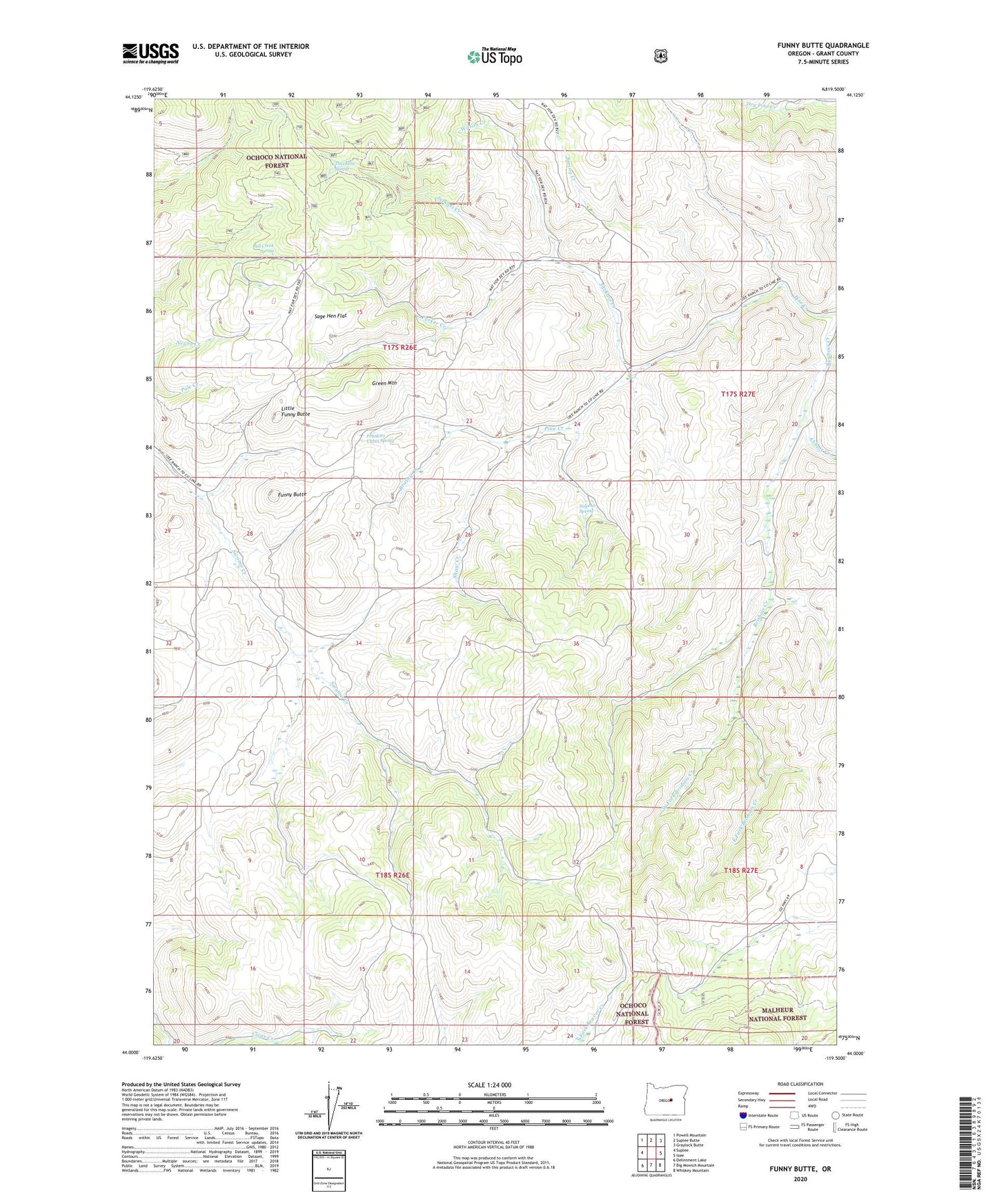
2020 topographic map quadrangle Funny Butte in the state of Oregon. Scale: 1:24000. Based on the newly updated USGS 7.5' US Topo map series, this map is in the following counties: Grant. The map contains contour data, water features, and other items you are used to seeing on USGS maps, but also has updated roads and other features. This is the next generation of topographic maps. Printed on high-quality waterproof paper with UV fade-resistant inks.
Quads adjacent to this one:
West: Suplee
Northwest: Powell Mountain
North: Suplee Butte
Northeast: Graylock Butte
East: Izee
Southeast: Whiskey Mountain
South: Big Mowich Mountain
Southwest: Delintment Lake
Contains the following named places: Abbott Creek, Agar Mountain, Brushy Creek, Bull Creek Spring, Cow Camp, East Fork Brisbois Creek, Frankies Cabin Spring, Funny Butte, Green Mountain, Haystack Butte, Howard Gulch, Jackass Creek, Little Funny Butte, Moon Creek Table, Parker Creek, Pyramid Point, Sage Hen Flat, Shaw Creek, Souley Ridge, Spring Creek, Sulphur Spring, Swamp Creek, Thursday Spring, West Fork Brisbois Creek, Wilson Creek