MyTopo
Powell Mountain Oregon US Topo Map
Couldn't load pickup availability
Also explore the Powell Mountain Forest Service Topo of this same quad for updated USFS data
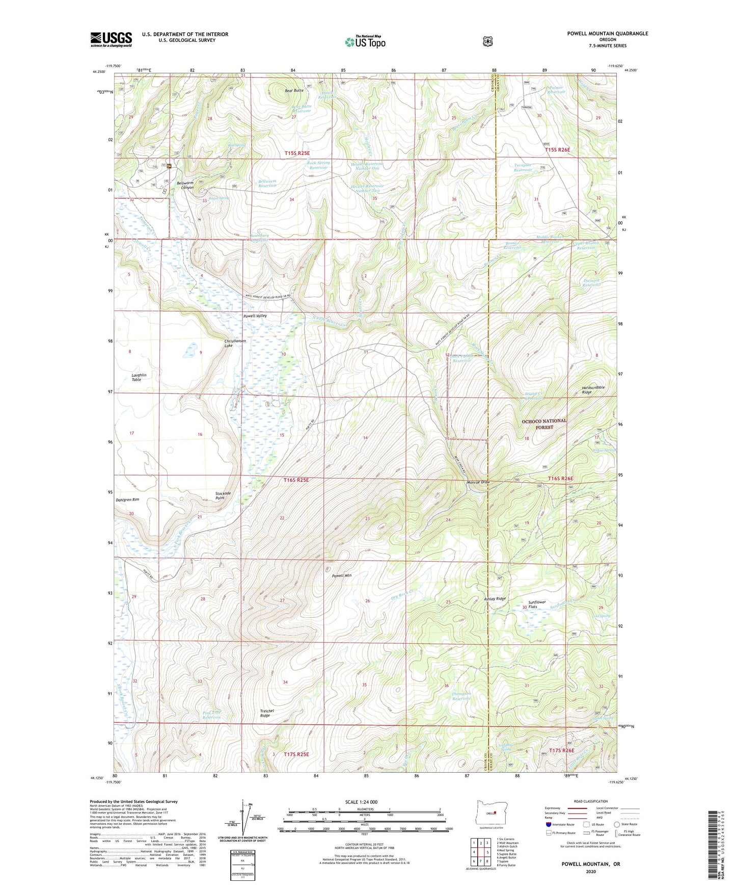
2023 topographic map quadrangle Powell Mountain in the state of Oregon. Scale: 1:24000. Based on the newly updated USGS 7.5' US Topo map series, this map is in the following counties: Crook, Grant. The map contains contour data, water features, and other items you are used to seeing on USGS maps, but also has updated roads and other features. This is the next generation of topographic maps. Printed on high-quality waterproof paper with UV fade-resistant inks.
Quads adjacent to this one:
West: Mud Spring
Northwest: Six Corners
North: Wolf Mountain
Northeast: Aldrich Gulch
East: Suplee Butte
Southeast: Funny Butte
South: Suplee
Southwest: Angell Butte
This map covers the same area as the classic USGS quad with code o44119b6.
Contains the following named places: Ashley Ridge, Bear Butte, Bear Butte Reservoir, Bear Creek, Beaverdam Creek, Bellworm Canyon, Bellworm Reservoir, Black Stump Creek, Bob Spring, Boundary Reservoir, Bronco Creek, Bronco Reservoir, Christiansen Lake, Cold Spring, Division Reservoir, Duck Puddle Reservoir, Hardscrabble Ridge, Hawk Reservoir, Heisler Creek, Heisler Reservoir Number One, Heisler Reservoir Number Two, Humphrey Ranch, Middle Bronco Reservoir, Monroe Draw, Palmer Ditch, Palmer Ranch, Palmer Reservoir, Pine Tree Reservoir, Powell Creek, Powell Mountain, Powell Ranch, Powell Valley, Rager Creek, Rager Spring, Rock Spring Reservoir, Stockade Point, Stump Creek Reservoir, Sunflower Flats, Suplee Spring, Tamarack Creek, Telephone Spring, Thompson Reservoir, Treichel Ridge, Turnpike Reservoir, Upper Bronco Reservoir