MyTopo
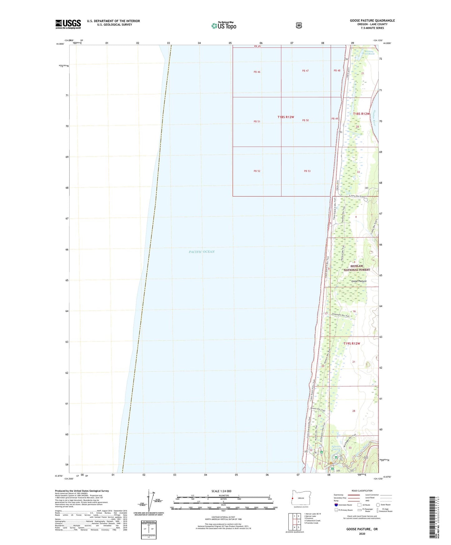
Goose Pasture Oregon US Topo Map
Couldn't load pickup availability
Also explore the Goose Pasture Forest Service Topo of this same quad for updated USFS data
2024 topographic map quadrangle Goose Pasture in the state of Oregon. Scale: 1:24000. Based on the newly updated USGS 7.5' US Topo map series, this map is in the following counties: Lane. The map contains contour data, water features, and other items you are used to seeing on USGS maps, but also has updated roads and other features. This is the next generation of topographic maps. Printed on high-quality waterproof paper with UV fade-resistant inks.
Quads adjacent to this one:
North: Mercer Lake OE W
Northeast: Mercer Lake
East: Florence
Southeast: Fivemile Creek
South: Tahkenitch Creek
This map covers the same area as the classic USGS quad with code o43124h2.
Contains the following named places: Driftwood II Recreation Site, Goose Pasture, Goose Pasture Recreation Site, Lagoon Recreation Site, Lodgepole Recreation Site, Parking Lot Marsh, Siltcoos Lagoon, Siltcoos Lake Dam, Stagecoach Trailhead, Waxmyrtle Recreation Site