MyTopo
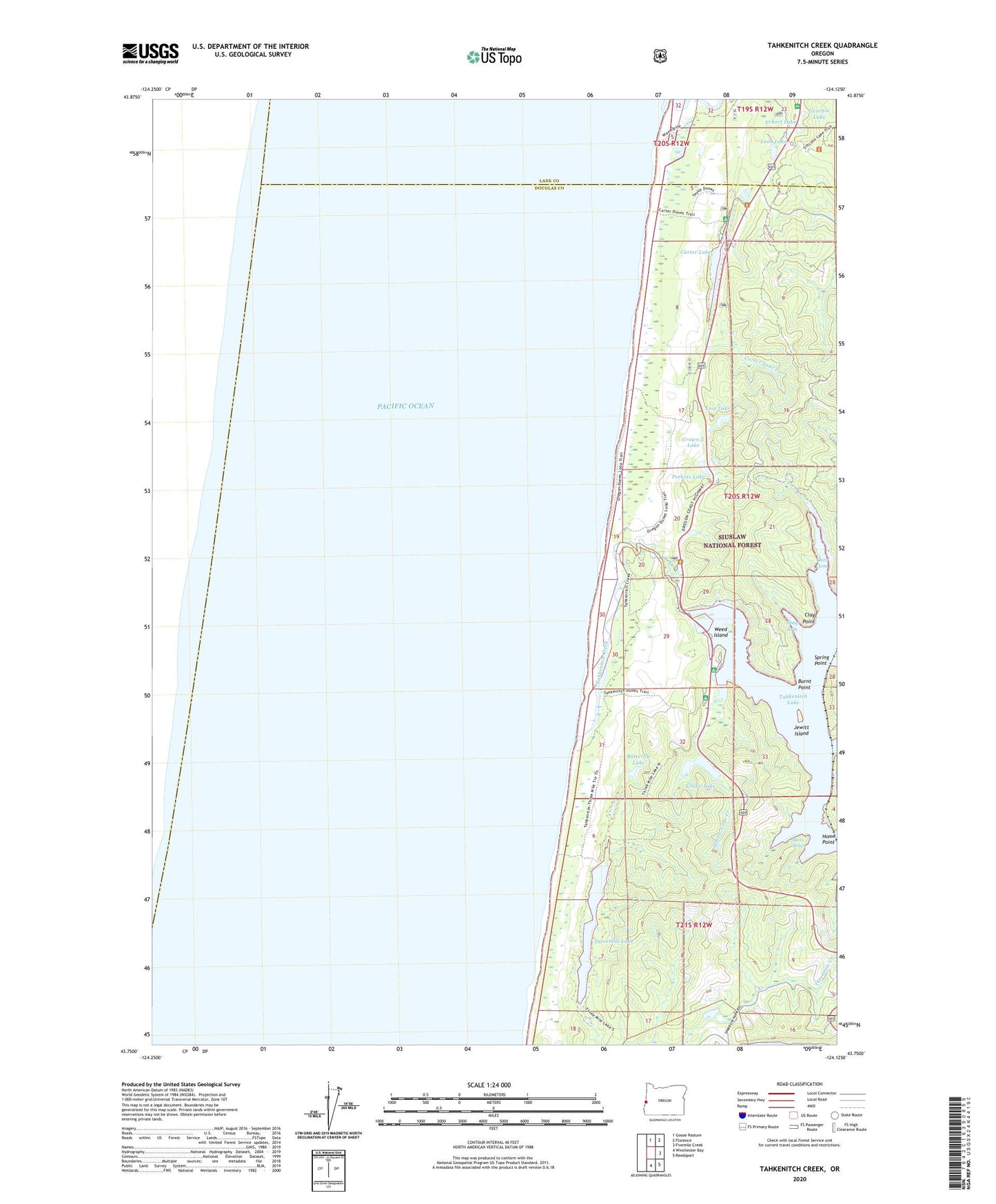
Tahkenitch Creek Oregon US Topo Map
Couldn't load pickup availability
Also explore the Tahkenitch Creek Forest Service Topo of this same quad for updated USFS data
2024 topographic map quadrangle Tahkenitch Creek in the state of Oregon. Scale: 1:24000. Based on the newly updated USGS 7.5' US Topo map series, this map is in the following counties: Douglas, Lane. The map contains contour data, water features, and other items you are used to seeing on USGS maps, but also has updated roads and other features. This is the next generation of topographic maps. Printed on high-quality waterproof paper with UV fade-resistant inks.
Quads adjacent to this one:
North: Goose Pasture
Northeast: Florence
East: Fivemile Creek
Southeast: Reedsport
South: Winchester Bay
This map covers the same area as the classic USGS quad with code o43124g2.
Contains the following named places: Bass Arms, Burnt Point, Butterfly Lake, Carter Dunes Trail, Carter Lake, Carter Lake Boat Ramp, Carter Lake Creek, Carter Lake Recreation Site, Clay Point, Crown Z Lake, Crown Zellerback Campground, Deer Arm, East Carter Campground, East Cater Boat Ramp, Elbow Lake, Elbow Lake Campground, Elbow Lake Creek, Erhart Lake, Georgia Lake, Home Point, Jewitt Island, Kroll, Kroll Post Office, Loon Lake, Lost Lake, Lost Lake Campground, Oregon Dunes Recreation Site, Overlook Loop Trail, Perkins Lake, Shag Arm, Siltcoos Lookout, Siltcoos Recreation Site, Siltcoos River, Smith River Ranger Station, Spring Point, Tahkenitch Boat Landing, Tahkenitch Boat Ramp, Tahkenitch Creek, Tahkenitch Lake, Tahkenitch Lake Dam, Tahkenitch Landing Recreation Site, Tahkenitch Recreation Site, Tahkenitch Trail, Threemile Lake, Threemile Lake Trail, W D Hull Mill, Waxmyrtle Trail, Weed Island, ZIP Code: 97441