MyTopo
Gray Butte Oregon US Topo Map
Couldn't load pickup availability
Also explore the Gray Butte Forest Service Topo of this same quad for updated USFS data
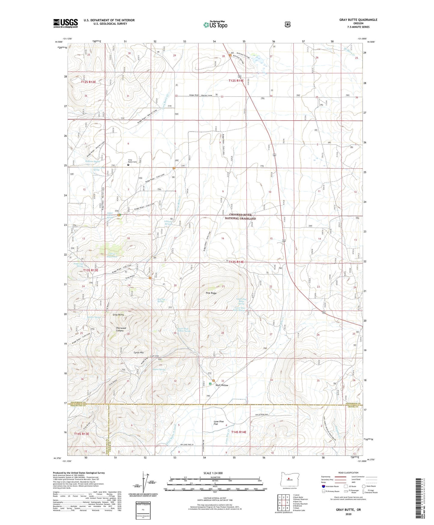
2023 topographic map quadrangle Gray Butte in the state of Oregon. Scale: 1:24000. Based on the newly updated USGS 7.5' US Topo map series, this map is in the following counties: Jefferson, Crook, Deschutes. The map contains contour data, water features, and other items you are used to seeing on USGS maps, but also has updated roads and other features. This is the next generation of topographic maps. Printed on high-quality waterproof paper with UV fade-resistant inks.
Quads adjacent to this one:
West: Opal City
Northwest: Culver
North: Buck Butte
Northeast: Brewer Reservoir
East: Grizzly Mountain
Southeast: Houston Lake
Southwest: Redmond
This map covers the same area as the classic USGS quad with code o44121d1.
Contains the following named places: Adams Spring, Compressor Station Number 11 Airstrip, Crooked River National Grasslands Headquarters, Cyrus Hill, Cyrus Hill Pond, Cyrus Horse Camp, Desert Post Office, Gray Butte, Gray Butte Cemetery, Kings Gap Spring, Lamonta, Lamonta Post Office, Lithgow Spring, Lone Pine Artesian Well, Lone Pine Flat, Lone Pine School, Lower Cyrus Spring, Lower Pine Ridge Spring, Lower Skull Hollow Spring, McCoin Orchard, Pilot Butte North Canal, Pilot Butte South Canal, Pine Ridge, Pine Ridge Corral, Red Top Spring, Rimrock Springs Wildlife Management Area, Rodman Spring, Scales Corral, Skull Hollow, Sumner Spring, Upper Cyrus Spring, Upper Pine Ridge Spring, Weigand Well