MyTopo
Grizzly Mountain Oregon US Topo Map
Couldn't load pickup availability
Also explore the Grizzly Mountain Forest Service Topo of this same quad for updated USFS data
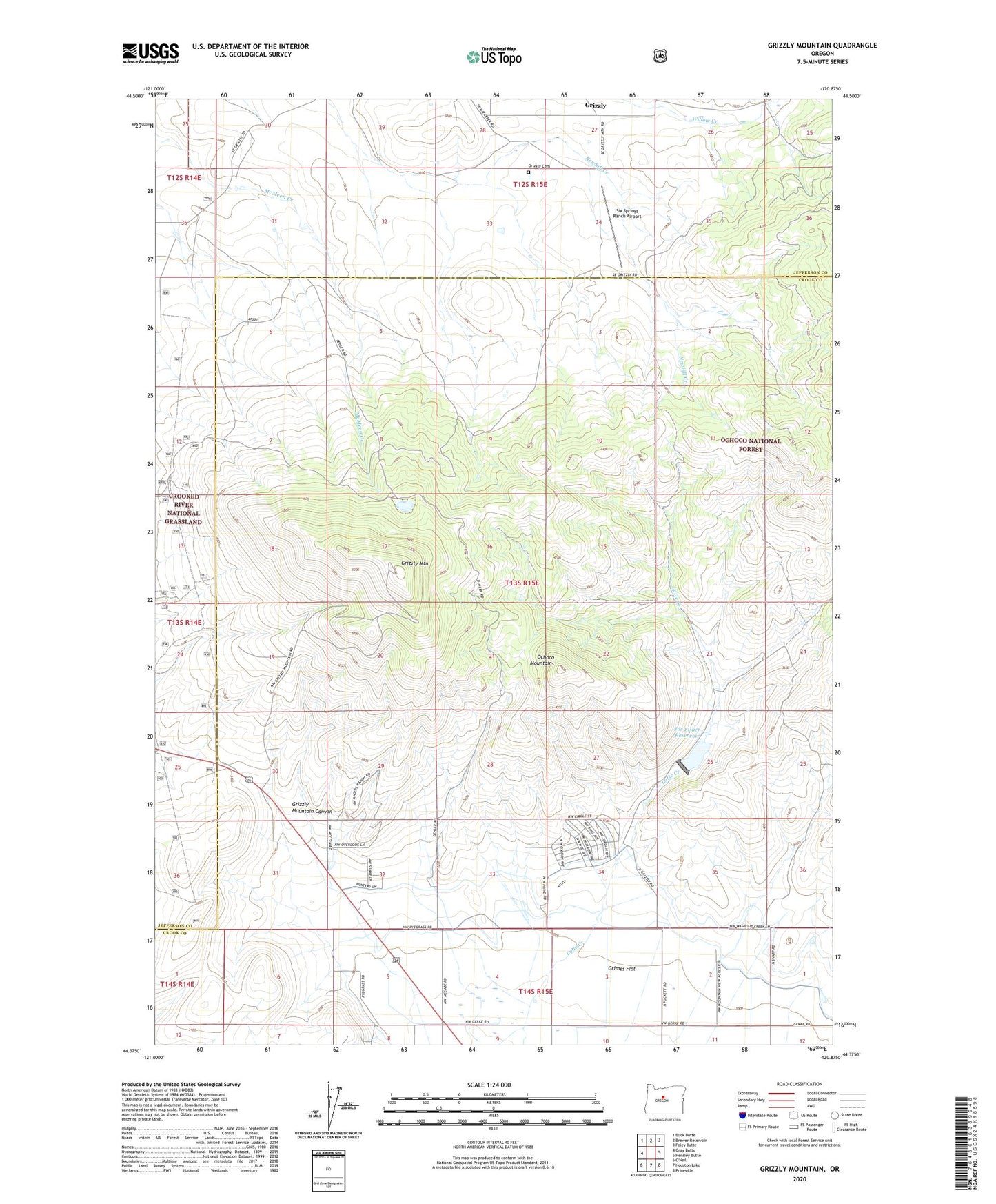
2024 topographic map quadrangle Grizzly Mountain in the state of Oregon. Scale: 1:24000. Based on the newly updated USGS 7.5' US Topo map series, this map is in the following counties: Crook, Jefferson. The map contains contour data, water features, and other items you are used to seeing on USGS maps, but also has updated roads and other features. This is the next generation of topographic maps. Printed on high-quality waterproof paper with UV fade-resistant inks.
Quads adjacent to this one:
West: Gray Butte
Northwest: Buck Butte
North: Brewer Reservoir
Northeast: Foley Butte
East: Hensley Butte
Southeast: Prineville
South: Houston Lake
This map covers the same area as the classic USGS quad with code o44120d8.
Contains the following named places: Fisher Dam, Grimes Flat, Grizzly, Grizzly Cemetery, Grizzly Mountain, Grizzly Mountain Canyon, Grizzly Post Office, Joe Fisher Ranch, Joe Fisher Reservoir, Negus Ranch, Ochoco West Census Designated Place, Ochoco West Sanitary District Sewage Treatment Lagoons, Six Springs Ranch Airport