MyTopo
Groundhog Mountain Oregon US Topo Map
Couldn't load pickup availability
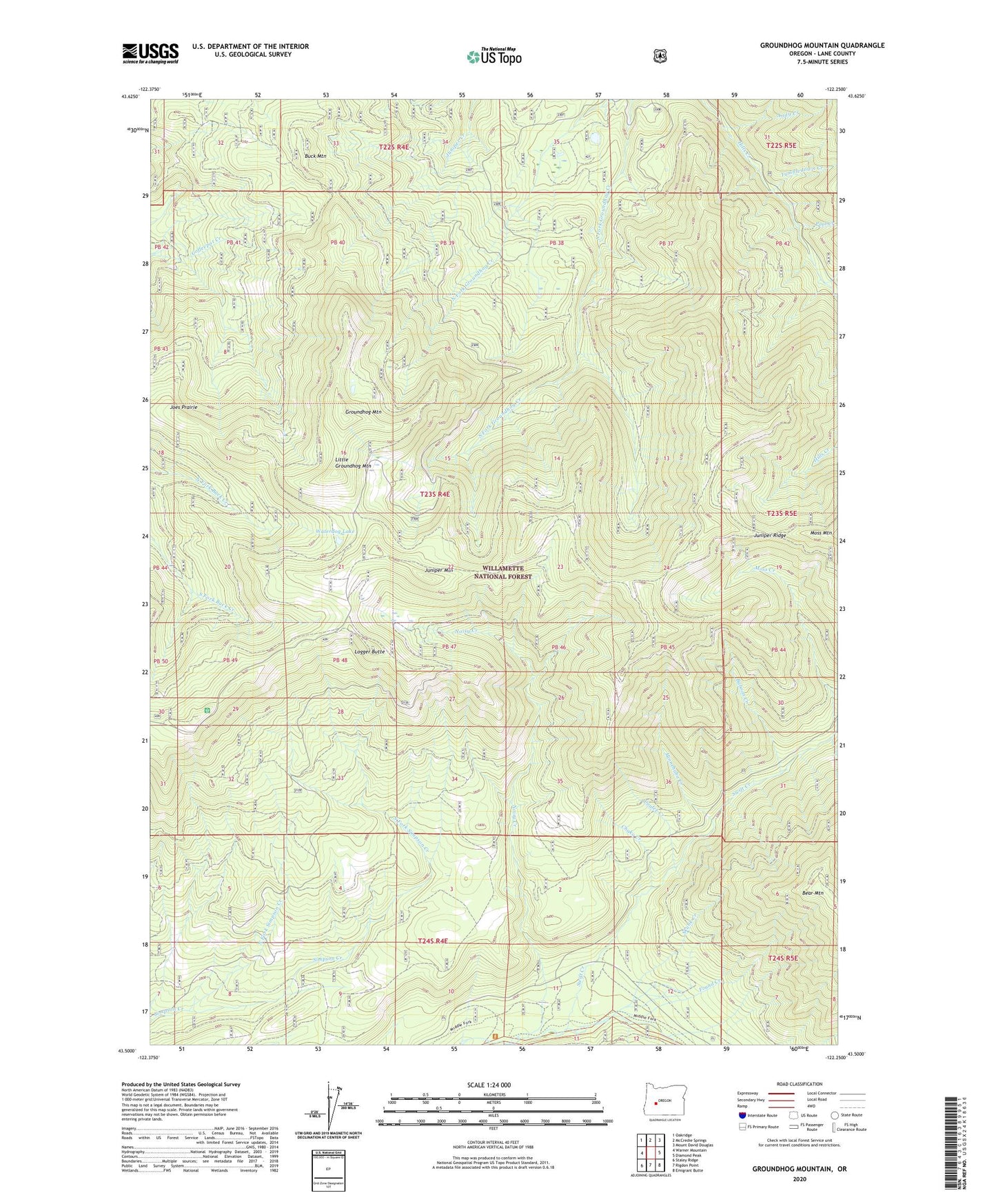
2020 topographic map quadrangle Groundhog Mountain in the state of Oregon. Scale: 1:24000. Based on the newly updated USGS 7.5' US Topo map series, this map is in the following counties: Lane. The map contains contour data, water features, and other items you are used to seeing on USGS maps, but also has updated roads and other features. This is the next generation of topographic maps. Printed on high-quality waterproof paper with UV fade-resistant inks.
Quads adjacent to this one:
West: Warner Mountain
Northwest: Oakridge
North: McCredie Springs
Northeast: Mount David Douglas
East: Diamond Peak
Southeast: Emigrant Butte
South: Rigdon Point
Southwest: Staley Ridge
Contains the following named places: Andy Creek, Baboon Creek, Bear Mountain Trail, Buck Mountain, Chako Creek, Coulee Creek, Found Creek, Groundhog Mountain, Joes Prairie, Juniper Mountain, Juniper Trail, Leader Post Office, Little Groundhog Mountain, Logger Butte, Logger Butte Recreation Site, Mac Creek, Minnehaha Creek, Moss Creek, Noisy Creek, Noisy Creek Forest Camp, North Fork Simpson Creek, Pool Creek, Sharps Prairie, Skunk Creek, South Fork Simpson Creek, Swift Creek, Swift Creek Trail, Tumbledown Creek, Warner Mountain Lookout, Waterdog Lake, Wolf Creek, Wolf Shelter