MyTopo
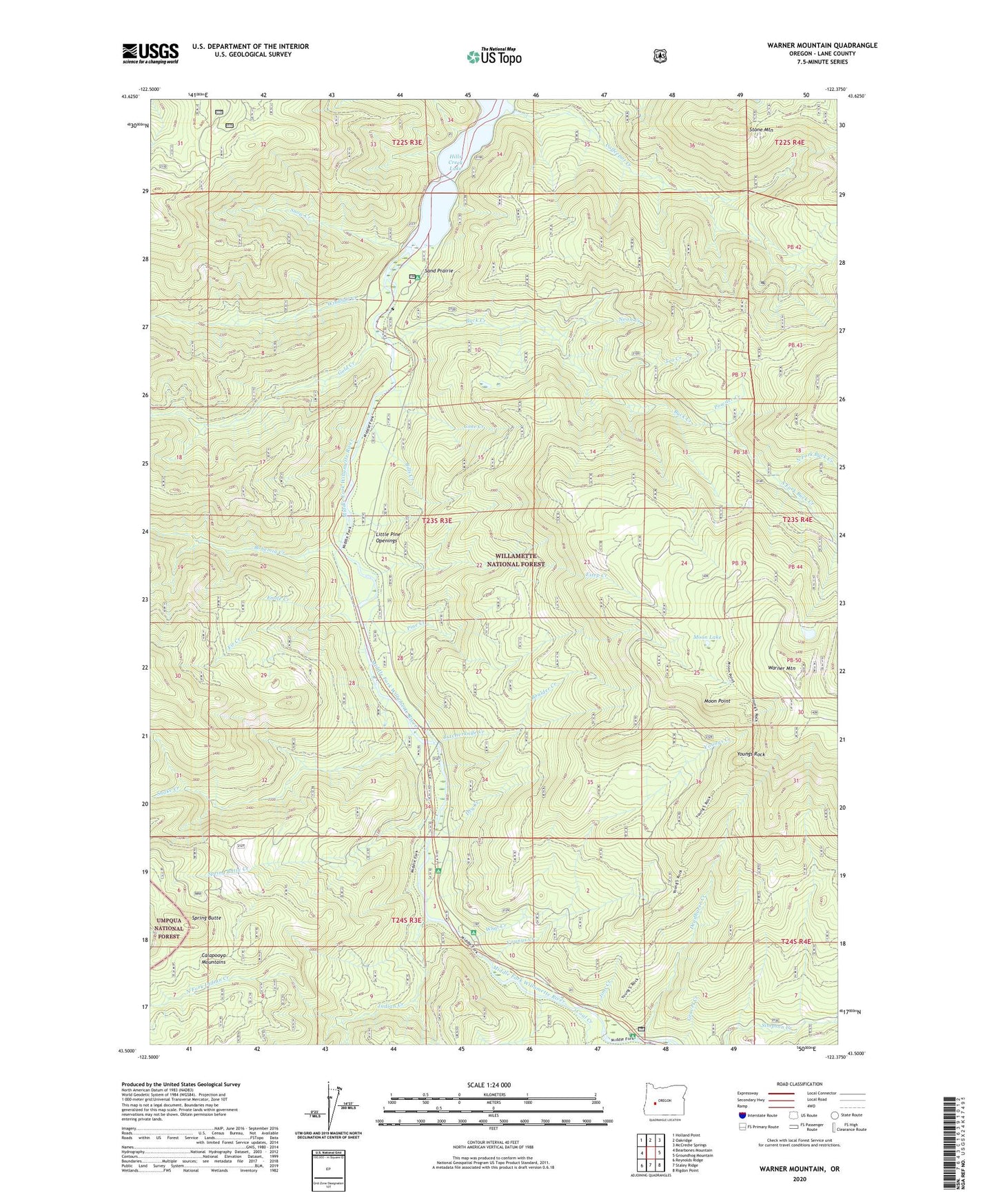
Warner Mountain Oregon US Topo Map
Couldn't load pickup availability
Also explore the Warner Mountain Forest Service Topo of this same quad for updated USFS data
2024 topographic map quadrangle Warner Mountain in the state of Oregon. Scale: 1:24000. Based on the newly updated USGS 7.5' US Topo map series, this map is in the following counties: Lane. The map contains contour data, water features, and other items you are used to seeing on USGS maps, but also has updated roads and other features. This is the next generation of topographic maps. Printed on high-quality waterproof paper with UV fade-resistant inks.
Quads adjacent to this one:
West: Bearbones Mountain
Northwest: Holland Point
North: Oakridge
Northeast: McCredie Springs
East: Groundhog Mountain
Southeast: Rigdon Point
South: Staley Ridge
Southwest: Reynolds Ridge
This map covers the same area as the classic USGS quad with code o43122e4.
Contains the following named places: Bills Creek, Bingham Boat Ramp, Bingham Recreation Site, Bohemia Creek, Boulder Creek, Buck Creek, Butcherknife Creek, Campers Flat Recreation Site, Coal Creek, Coffeepot Creek, Cone Creek, Croft Forest Camp, Cynosure Forest Camp, Deadhorse Creek, Dry Creek, Emile Creek, Estep Creek, Fir Creek, Gold Creek, Grass Mountain Trail, Indian Creek, Jims Creek, Little Pine Openings, Moon Lake, Moon Lake Shelter, Moon Lake Trail, Moon Point, Noon Creek, North Fork Buck Creek, North Fork Indian Creek, Pine Creek, Powder Creek, Rocky Point Way, Sand Prairie, Sand Prairie Recreation Site, Secret Recreation Site, Snake Creek, Snow Creek, South Fork Buck Creek, Spring Butte, Spring Butte Creek, Stone Mountain, Tea Creek, Warner Mountain, What Creek, Windfall Creek, Youngs Creek, Youngs Rock