MyTopo
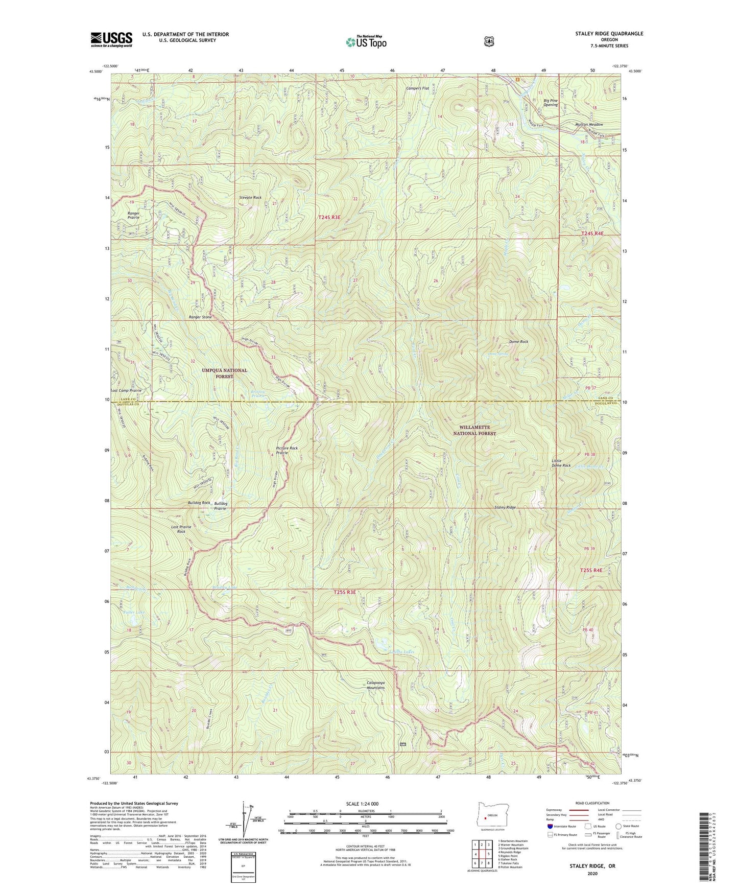
Staley Ridge Oregon US Topo Map
Couldn't load pickup availability
Also explore the Staley Ridge Forest Service Topo of this same quad for updated USFS data
2024 topographic map quadrangle Staley Ridge in the state of Oregon. Scale: 1:24000. Based on the newly updated USGS 7.5' US Topo map series, this map is in the following counties: Lane, Douglas. The map contains contour data, water features, and other items you are used to seeing on USGS maps, but also has updated roads and other features. This is the next generation of topographic maps. Printed on high-quality waterproof paper with UV fade-resistant inks.
Quads adjacent to this one:
West: Reynolds Ridge
Northwest: Bearbones Mountain
North: Warner Mountain
Northeast: Groundhog Mountain
East: Rigdon Point
Southeast: Potter Mountain
South: Toketee Falls
Southwest: Illahee Rock
This map covers the same area as the classic USGS quad with code o43122d4.
Contains the following named places: Bear Camp, Big Pine Opening, Bog Camp Cabin, Bradley Lake, Bristow Prairie, Bristow Trail, Bulldog Prairie, Bulldog Rock, Campers Flat, Deadwood Creek, Dome Rock, Dome Spring, Fuller Lake, Gravel Creek, Indian Creek Trail, Little Dome Rock, Loletta Lakes, Lost Camp Trail, Lost Prairie Rock, Maple Creek, Mutton Meadow, Picture Rock Prairie, Ranger Prairie, Ranger Stone, Simpson Creek, Staley Creek, Staley Ridge, Staley Ridge Trail, Steeple Rock