MyTopo
Harper Oregon US Topo Map
Couldn't load pickup availability
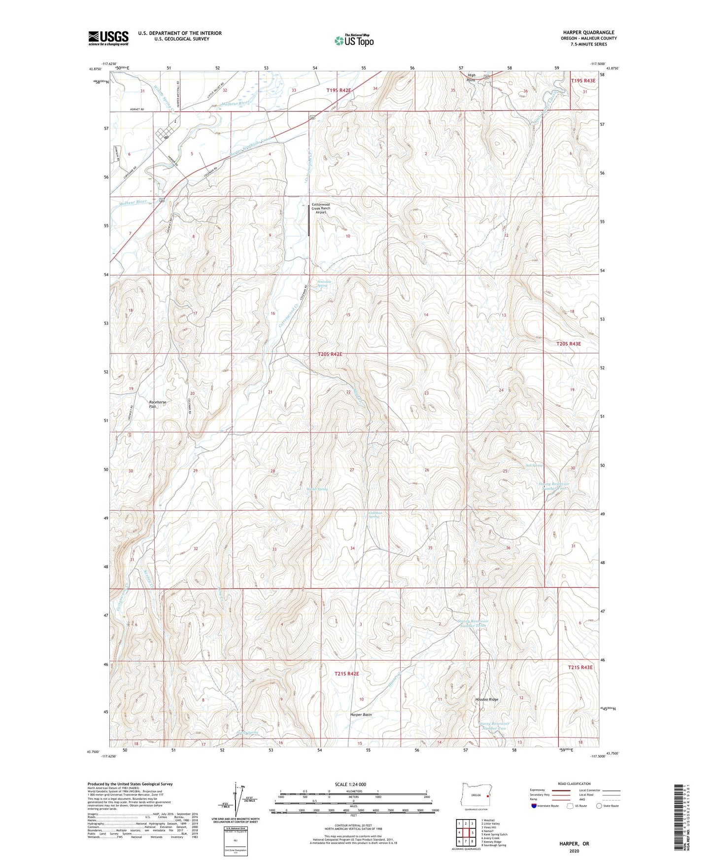
2023 topographic map quadrangle Harper in the state of Oregon. Scale: 1:24000. Based on the newly updated USGS 7.5' US Topo map series, this map is in the following counties: Malheur. The map contains contour data, water features, and other items you are used to seeing on USGS maps, but also has updated roads and other features. This is the next generation of topographic maps. Printed on high-quality waterproof paper with UV fade-resistant inks.
Quads adjacent to this one:
West: Namorf
Northwest: Westfall
North: Little Valley
Northeast: Vines Hill
East: Kane Spring Gulch
Southeast: Sourdough Spring
South: Keeney Ridge
Southwest: Avery Creek
This map covers the same area as the classic USGS quad with code o43117g5.
Contains the following named places: Basin Creek, Buckaroo Cabin, Callahan Spring, Cottonwood Creek Ranch Airport, Fenceline Spring, Harper, Harper Basin, Harper Junction, Harper Post Office, Harper School, Harper Southside Canal, High Point, Hunter Creek, Hunter Spring, Keeney Creek, Long Creek, Racehorse Flat, Racehorse Well, Salt Spring, Stacey Reservoir Number Four, Stacey Reservoir Number Three, Stacey Reservoir Number Two, Willow Spring Creek, Winter Spring