MyTopo
Avery Creek Oregon US Topo Map
Couldn't load pickup availability
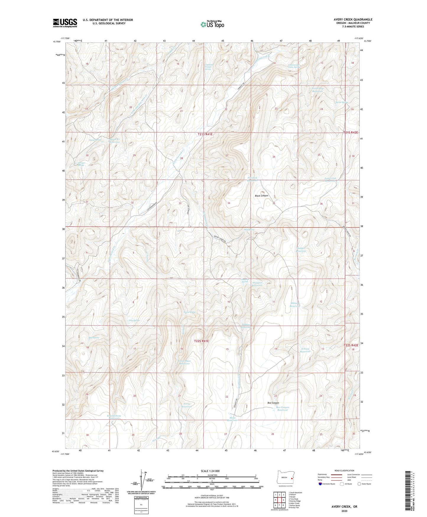
2024 topographic map quadrangle Avery Creek in the state of Oregon. Scale: 1:24000. Based on the newly updated USGS 7.5' US Topo map series, this map is in the following counties: Malheur. The map contains contour data, water features, and other items you are used to seeing on USGS maps, but also has updated roads and other features. This is the next generation of topographic maps. Printed on high-quality waterproof paper with UV fade-resistant inks.
Quads adjacent to this one:
West: Tims Peak
Northwest: South Mountain
North: Namorf
Northeast: Harper
East: Keeney Ridge
Southeast: Hurley Flat
South: Rufino Butte
Southwest: Alder Creek
This map covers the same area as the classic USGS quad with code o43117f6.
Contains the following named places: Avery Creek, Avery Reservoir, Avery Spring, Badger Reservoir, Box Canyon Reservoir, Chastain Spring, Copeland Trough Spring, Cottonwood Cabin Spring, Division Reservoir, Drip Spring, Fence Line Reservoir, Gacey Spring, Good Place Reservoir, Hidden Reservoir, Hu Tsi Tehaga Creek, Knucklebone Reservoir, Mesa Reservoir, Military Reservoir, Mud Spring, North Drip Reservoir, O'Toole Reservoir, Petrified Reservoir, Riley Place, Sai-be Spring, Sixteenmile Creek, Squaw Creek Dam, Squaw Creek Reservoir, Stringer Spring, Ti-he-cha-paa nena Creek