MyTopo
Sourdough Spring Oregon US Topo Map
Couldn't load pickup availability
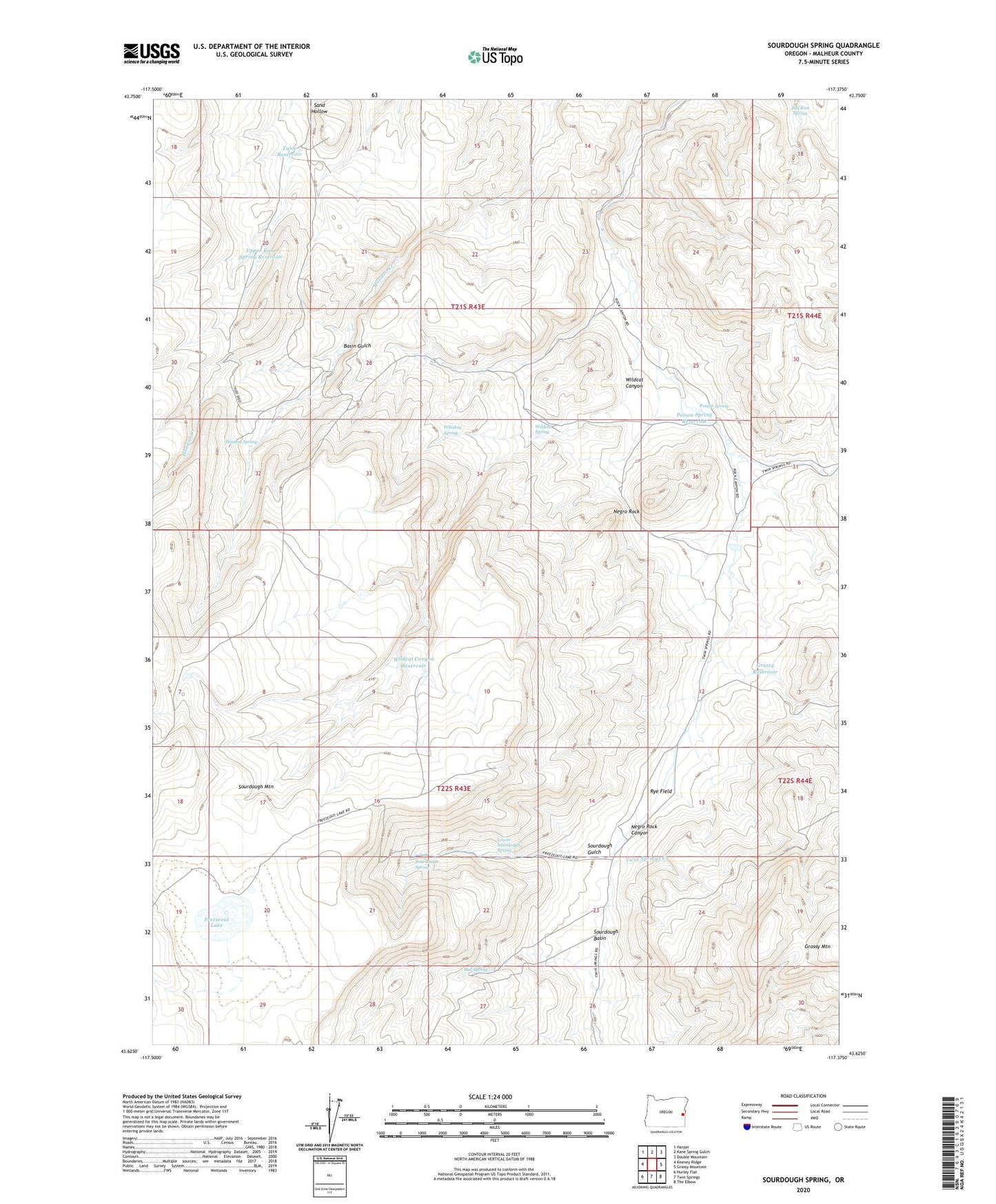
2023 topographic map quadrangle Sourdough Spring in the state of Oregon. Scale: 1:24000. Based on the newly updated USGS 7.5' US Topo map series, this map is in the following counties: Malheur. The map contains contour data, water features, and other items you are used to seeing on USGS maps, but also has updated roads and other features. This is the next generation of topographic maps. Printed on high-quality waterproof paper with UV fade-resistant inks.
Quads adjacent to this one:
West: Keeney Ridge
Northwest: Harper
North: Kane Spring Gulch
Northeast: Double Mountain
East: Grassy Mountain
Southeast: The Elbow
South: Twin Springs
Southwest: Hurley Flat
This map covers the same area as the classic USGS quad with code o43117f4.
Contains the following named places: Basin Gulch, Bull Spring, Freezeout Lake, Grassy Reservoir, Hoodoo Spring, Lower Sourdough Spring, Negro Rock, Poison Spring, Poison Spring Reservoir, Red Rim Spring, Rye Field, Sourdough Basin, Sourdough Gulch, Sourdough Mountain, Sourdough Spring, Table Reservoir, Upper Kane Spring Reservoir, Whiskey Spring, Wildcat Canyon, Wildcat Canyon Reservoir, Wildcat Spring