MyTopo
Harvey Creek Oregon US Topo Map
Couldn't load pickup availability
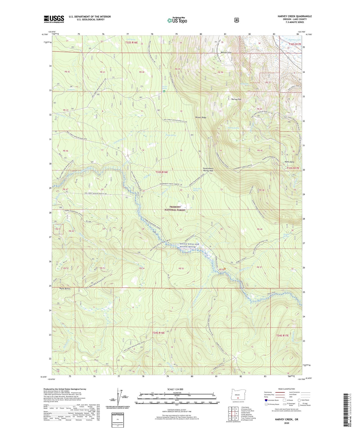
2020 topographic map quadrangle Harvey Creek in the state of Oregon. Scale: 1:24000. Based on the newly updated USGS 7.5' US Topo map series, this map is in the following counties: Lake. The map contains contour data, water features, and other items you are used to seeing on USGS maps, but also has updated roads and other features. This is the next generation of topographic maps. Printed on high-quality waterproof paper with UV fade-resistant inks.
Quads adjacent to this one:
West: Shake Butte
Northwest: Pole Butte
North: Fremont Point
Northeast: South of Ana River
East: Slide Mountain
Southeast: Coffeepot Creek
South: Lee Thomas Crossing
Southwest: Sandhill Crossing
Contains the following named places: Bed Spring, Bennett Flat, Boulder Creek, Boulder Spring, Cold Spring, Cummings Creek, Currier Spring, Government Harvey Pass, Hanan Sycan Trailhead, Hanan/Coffeepot Spring Recreation Site, Harvey Creek, Harvey Flat, Harvey Spring, Hogwallow Spring, Kates Dairy, Kelly Creek, Nixon Creek, Phelps Spring, Rock Creek, Rock Creek Recreation Site, Skull Creek Camp, Snow Cabin, South Fork Sycan River, Taylor Buttes, Winter Ridge, Winter Rim Trailhead, Wooley Creek