MyTopo
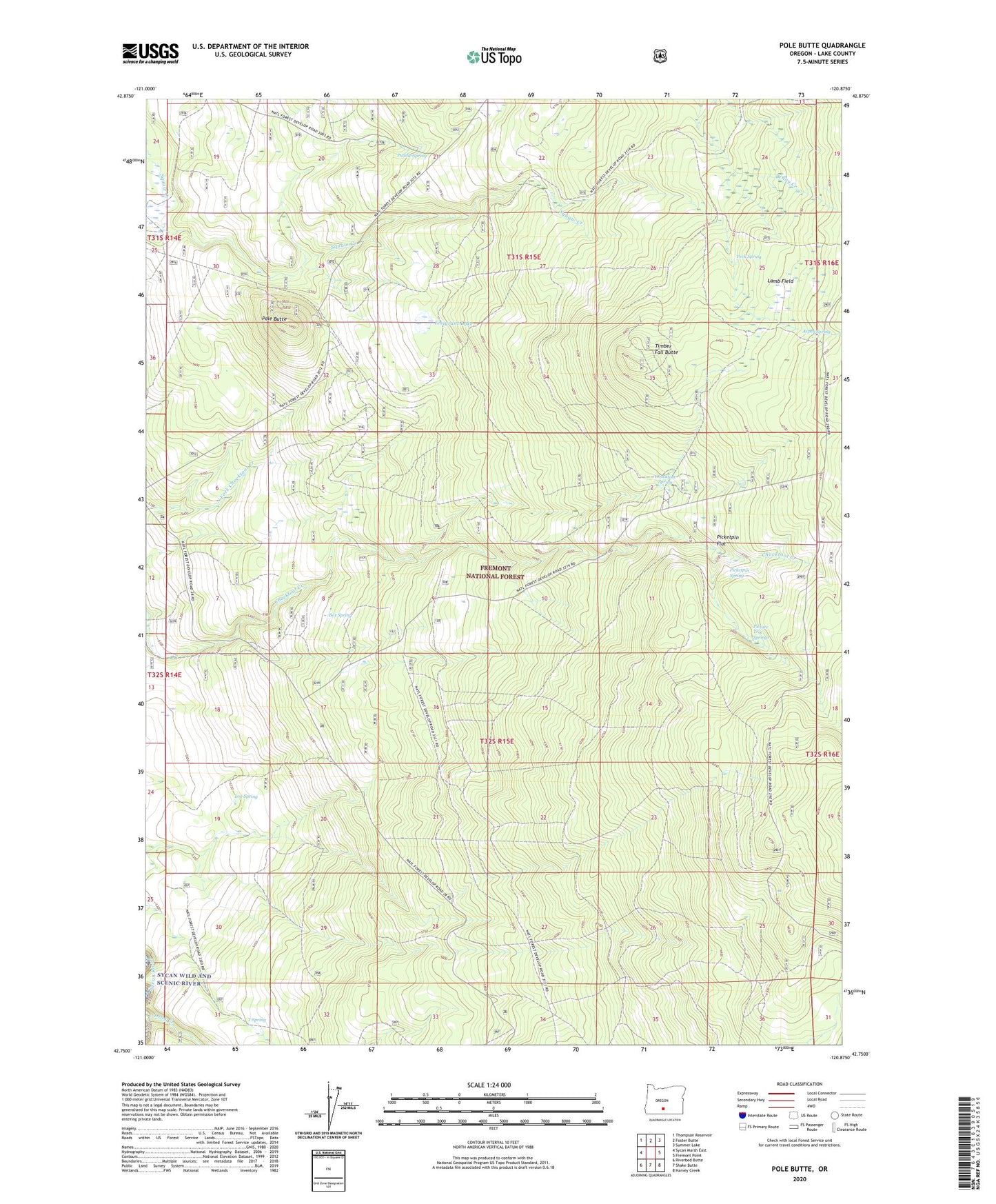
Pole Butte Oregon US Topo Map
Couldn't load pickup availability
Also explore the Pole Butte Forest Service Topo of this same quad for updated USFS data
2023 topographic map quadrangle Pole Butte in the state of Oregon. Scale: 1:24000. Based on the newly updated USGS 7.5' US Topo map series, this map is in the following counties: Lake. The map contains contour data, water features, and other items you are used to seeing on USGS maps, but also has updated roads and other features. This is the next generation of topographic maps. Printed on high-quality waterproof paper with UV fade-resistant inks.
Quads adjacent to this one:
West: Sycan Marsh East
Northwest: Thompson Reservoir
North: Foster Butte
Northeast: Summer Lake
East: Fremont Point
Southeast: Harvey Creek
South: Shake Butte
Southwest: Riverbed Butte
This map covers the same area as the classic USGS quad with code o42120g8.
Contains the following named places: Aspen Spring, Box Spring, Camp Nine, Chocktoot Spring, Emigrant Lake, Lamb Field, Log Spring, Peck Spring, Picketpin Flat, Picketpin Spring, Picture Tree Springs, Pole Butte, Pole Butte Sno-Park, Puddle Spring, Puddle Spring Work Center, Sycan Capacitor Station, T Spring, Timber Fall Butte