MyTopo
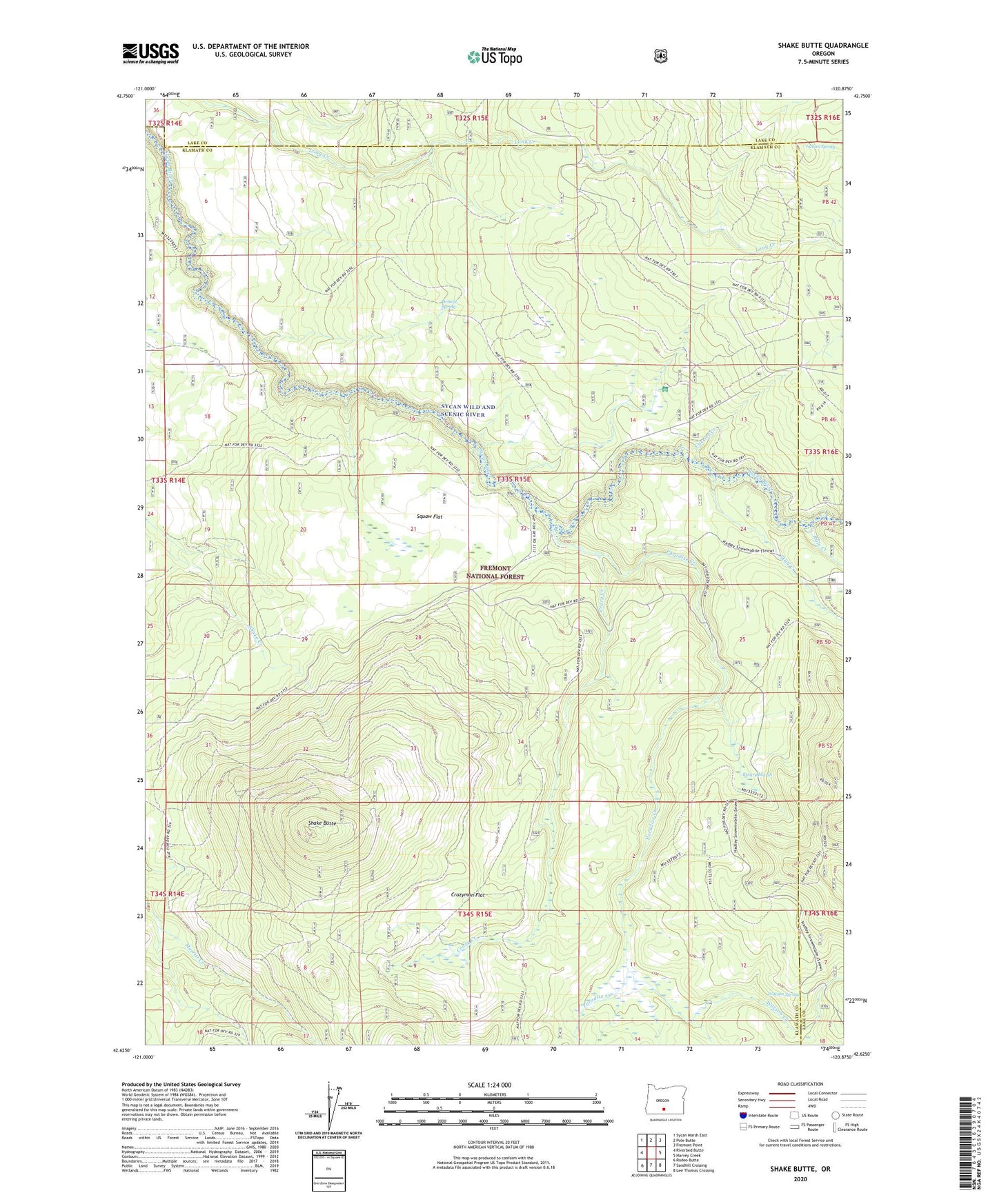
Shake Butte Oregon US Topo Map
Couldn't load pickup availability
Also explore the Shake Butte Forest Service Topo of this same quad for updated USFS data
2023 topographic map quadrangle Shake Butte in the state of Oregon. Scale: 1:24000. Based on the newly updated USGS 7.5' US Topo map series, this map is in the following counties: Klamath, Lake. The map contains contour data, water features, and other items you are used to seeing on USGS maps, but also has updated roads and other features. This is the next generation of topographic maps. Printed on high-quality waterproof paper with UV fade-resistant inks.
Quads adjacent to this one:
West: Riverbed Butte
Northwest: Sycan Marsh East
North: Pole Butte
Northeast: Fremont Point
East: Harvey Creek
Southeast: Lee Thomas Crossing
South: Sandhill Crossing
Southwest: Rodeo Butte
This map covers the same area as the classic USGS quad with code o42120f8.
Contains the following named places: Crazy Creek, Crazyman Flat, Currier Creek, Currier Guard Station, Driscol Spring, Emigrant Crossing, Indian Spring, Kingry Marsh, Paradise Creek, Pikes Crossing Recreation Site, Rifle Creek, Shake Butte, Shake Butte Lookout, Skull Creek, Squaw Flat, Watson Creek, Watson Spring