MyTopo
Hooker Creek Oregon US Topo Map
Couldn't load pickup availability
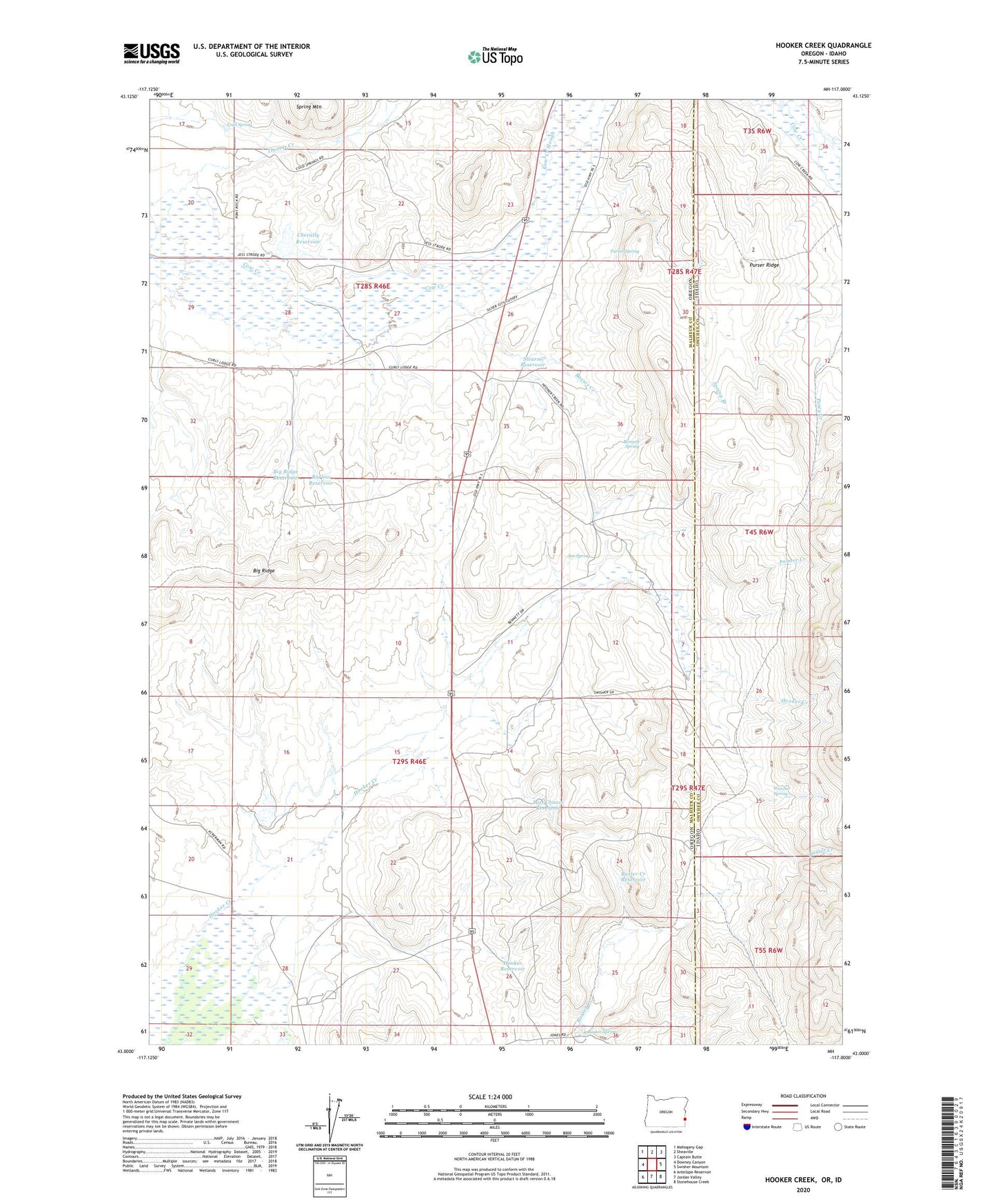
2023 topographic map quadrangle Hooker Creek in the states of Oregon, Idaho. Scale: 1:24000. Based on the newly updated USGS 7.5' US Topo map series, this map is in the following counties: Malheur, Owyhee. The map contains contour data, water features, and other items you are used to seeing on USGS maps, but also has updated roads and other features. This is the next generation of topographic maps. Printed on high-quality waterproof paper with UV fade-resistant inks.
Quads adjacent to this one:
West: Downey Canyon
Northwest: Mahogany Gap
North: Sheaville
Northeast: Captain Butte
East: Swisher Mountain
Southeast: Stonehouse Creek
South: Jordan Valley
Southwest: Antelope Reservoir
This map covers the same area as the classic USGS quad with code o43117a1.
Contains the following named places: Barlow Reservoir, Barlow Well, Baxter Creek, Baxter Creek Reservoir, Baxter Spring, Bennett Spring, Big Ridge, Big Ridge Reservoir, Carter Ranch, Chevally Reservoir, Chevally Reservoir Dam, Cold Spring, E Jones Ranch, Hooker Reservoir, Jim Spring, Last Chance Reservoir, Palmer Creek, Poacher Spring, Purser Ridge, Purser Spring, Spring Branch, Stearns Reservoir