MyTopo
Captain Butte Idaho US Topo Map
Couldn't load pickup availability
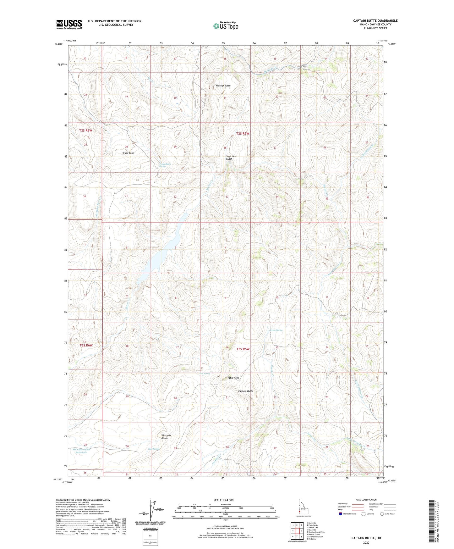
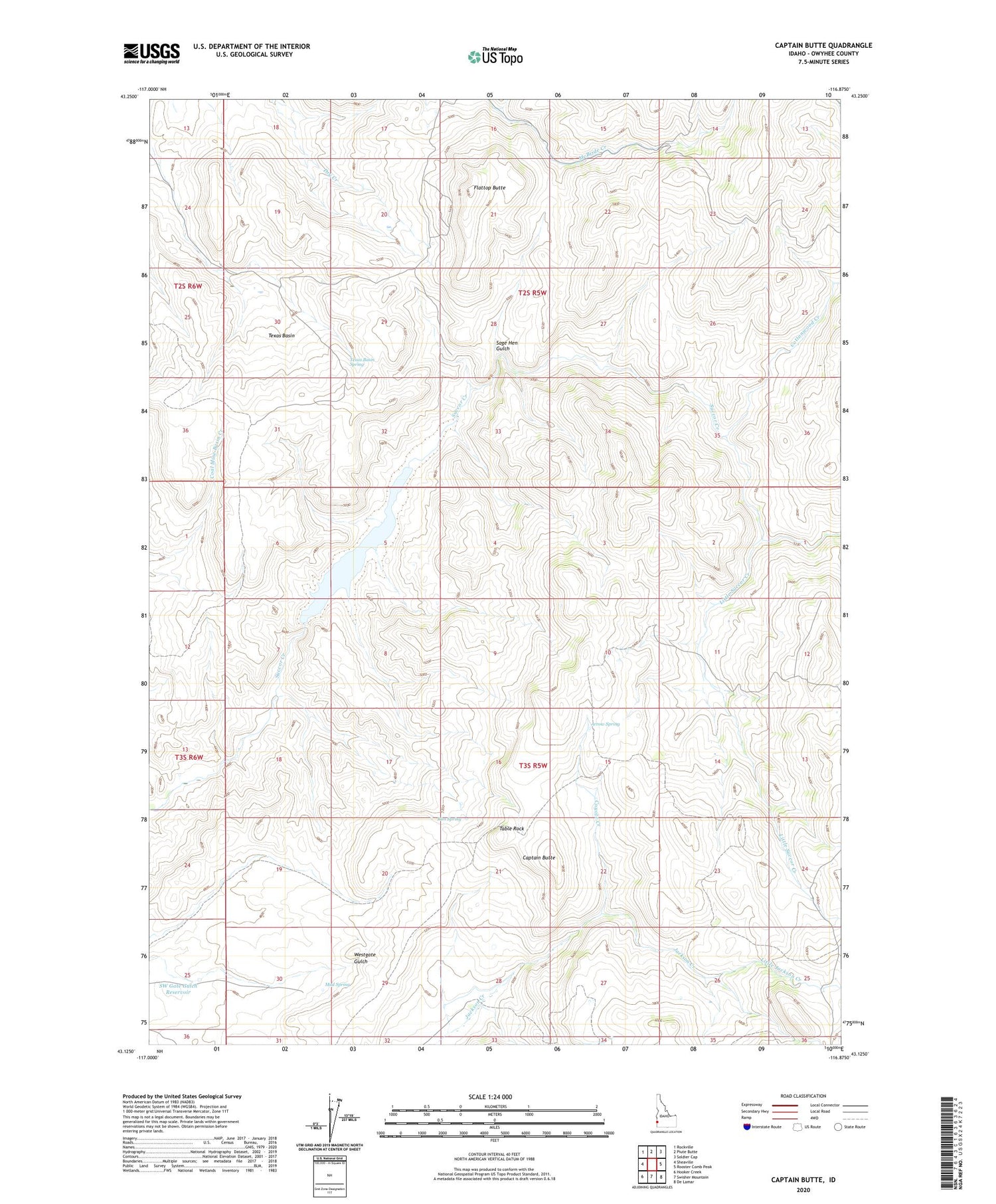
2023 topographic map quadrangle Captain Butte in the state of Idaho. Scale: 1:24000. Based on the newly updated USGS 7.5' US Topo map series, this map is in the following counties: Owyhee. The map contains contour data, water features, and other items you are used to seeing on USGS maps, but also has updated roads and other features. This is the next generation of topographic maps. Printed on high-quality waterproof paper with UV fade-resistant inks.
Quads adjacent to this one:
West: Sheaville
Northwest: Rockville
North: Piute Butte
Northeast: Soldier Cap
East: Rooster Comb Peak
Southeast: De Lamar
South: Swisher Mountain
Southwest: Hooker Creek
This map covers the same area as the classic USGS quad with code o43116b8.
Contains the following named places: Arrow Spring, Captain Butte, Cottonwood Creek, Coyote Creek, Flattop Butte, Little Jackson Creek, Little Succor Creek, Mud Spring, Rim Spring, Sage Hen Gulch, Succor Creek Reservoir, SW Gate Gulch Reservoir, Table Rock, Texas Basin, Texas Basin Dam, Texas Basin Reservoir, Texas Basin Spring