MyTopo
Stonehouse Creek Idaho US Topo Map
Couldn't load pickup availability
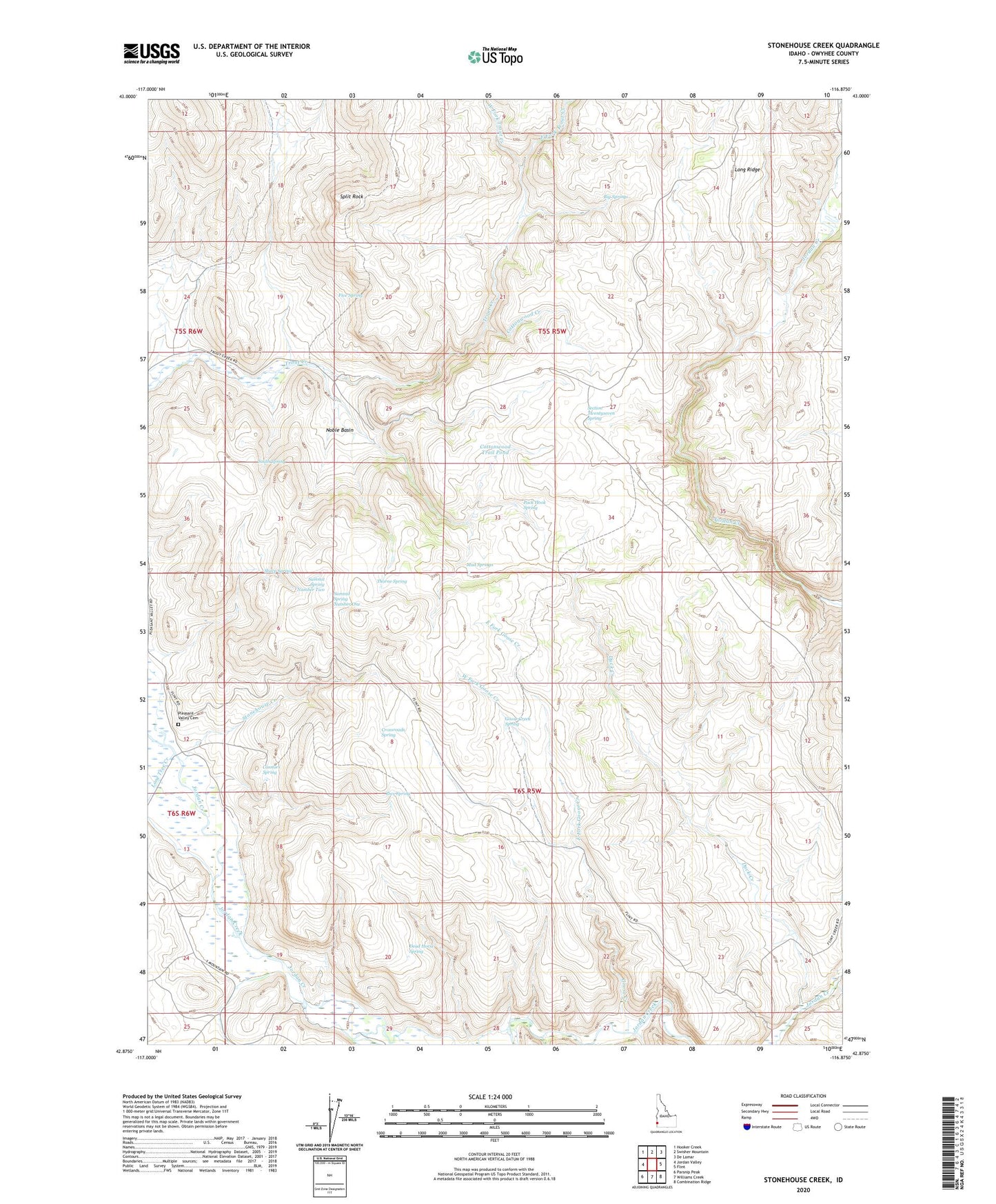
2023 topographic map quadrangle Stonehouse Creek in the state of Idaho. Scale: 1:24000. Based on the newly updated USGS 7.5' US Topo map series, this map is in the following counties: Owyhee. The map contains contour data, water features, and other items you are used to seeing on USGS maps, but also has updated roads and other features. This is the next generation of topographic maps. Printed on high-quality waterproof paper with UV fade-resistant inks.
Quads adjacent to this one:
West: Jordan Valley
Northwest: Hooker Creek
North: Swisher Mountain
Northeast: De Lamar
East: Flint
Southeast: Combination Ridge
South: Williams Creek
Southwest: Parsnip Peak
This map covers the same area as the classic USGS quad with code o42116h8.
Contains the following named places: Big Springs, Connors Canyon, Connors Spring, Cottonwood Creek, Cottonwood Trail Pond, Crossroads Spring, Dead Horse Spring, Duck Creek, East Fork Goose Creek, East Fork Trout Creek, East Goose Creek Pond, Five Spring, Goose Creek, Goose Creek Spring, Ibex Spring, Lone Tree Creek, Mud Springs, Mud Springs Pond, Noble Basin, Pack Hook Spring, Pleasant Valley Cemetery, Sams Pond, Section Twentyseven Spring, Sheep Spring, South Spring, Split Rock, Split Rock Canyon, Stonehouse Creek, Summit Spring Number One, Summit Spring Number Two, Thorne Spring, West Fork Goose Creek, West Fork Trout Creek, Williams Creek, Wood Canyon