MyTopo
Antelope Reservoir Oregon US Topo Map
Couldn't load pickup availability
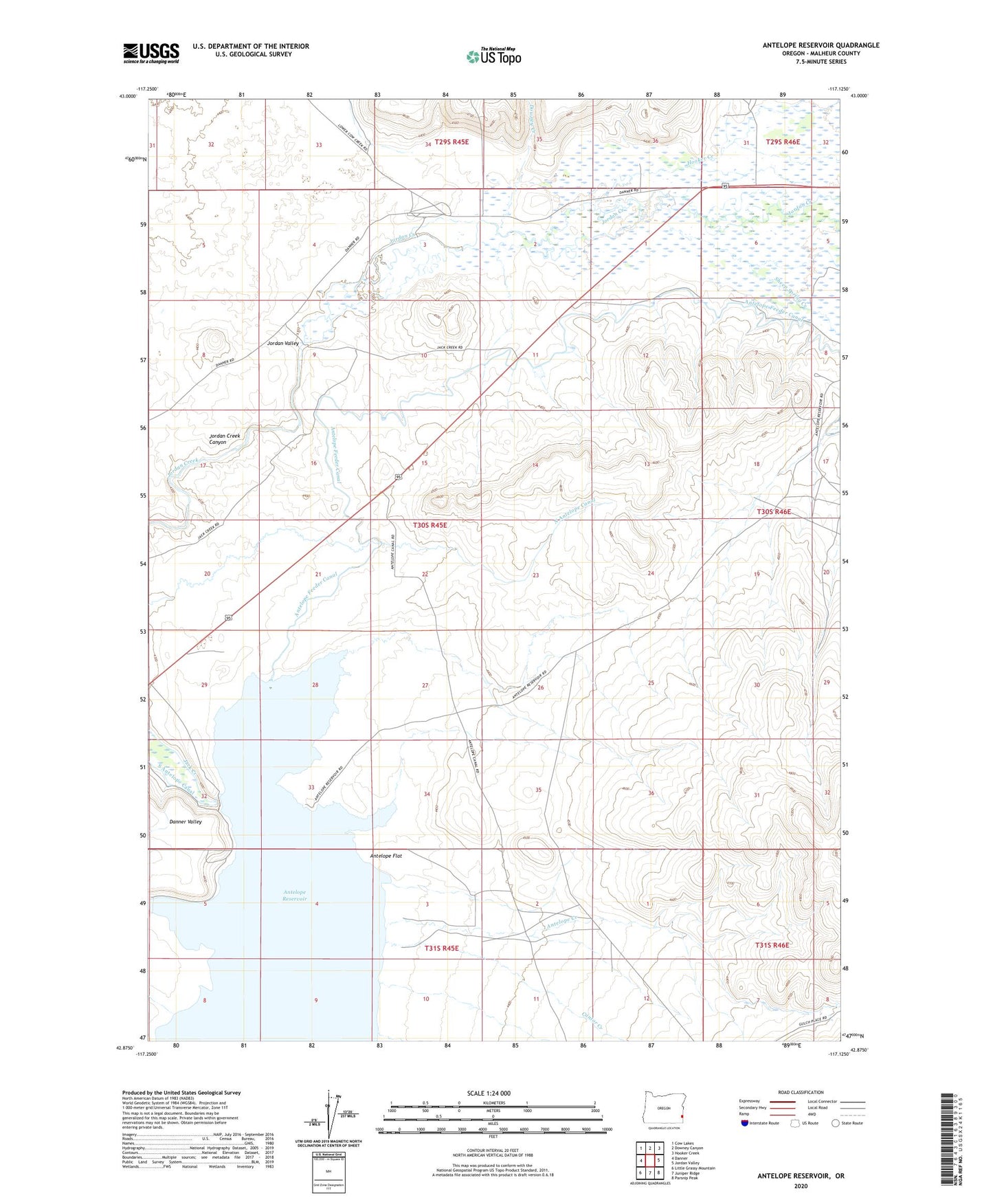
2024 topographic map quadrangle Antelope Reservoir in the state of Oregon. Scale: 1:24000. Based on the newly updated USGS 7.5' US Topo map series, this map is in the following counties: Malheur. The map contains contour data, water features, and other items you are used to seeing on USGS maps, but also has updated roads and other features. This is the next generation of topographic maps. Printed on high-quality waterproof paper with UV fade-resistant inks.
Quads adjacent to this one:
West: Danner
Northwest: Cow Lakes
North: Downey Canyon
Northeast: Hooker Creek
East: Jordan Valley
Southeast: Parsnip Peak
South: Juniper Ridge
Southwest: Little Grassy Mountain
This map covers the same area as the classic USGS quad with code o42117h2.
Contains the following named places: Antelope Creek, Antelope Dam, Antelope Feeder Canal, Antelope Flat, Antelope Reservoir, Antelope Reservoir Boat Launch, Cantor Creek, Downey Creek, Hooker Creek, Jordan Valley, Sharp Ditch, Sheep Spring Creek, Urlezaga Ditch