MyTopo
Stearns Butte Oregon US Topo Map
Couldn't load pickup availability
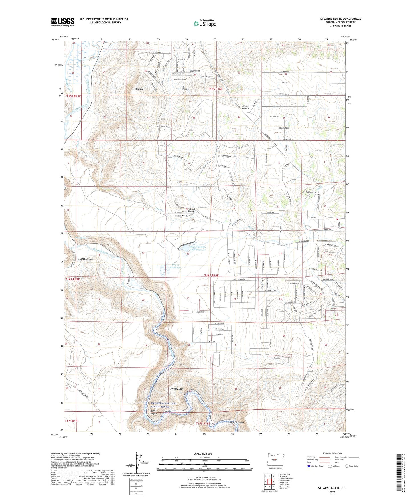
2024 topographic map quadrangle Stearns Butte in the state of Oregon. Scale: 1:24000. Based on the newly updated USGS 7.5' US Topo map series, this map is in the following counties: Crook. The map contains contour data, water features, and other items you are used to seeing on USGS maps, but also has updated roads and other features. This is the next generation of topographic maps. Printed on high-quality waterproof paper with UV fade-resistant inks.
Quads adjacent to this one:
West: Powell Buttes
Northwest: Houston Lake
North: Prineville
Northeast: Ochoco Reservoir
East: Eagle Rock
Southeast: Alkali Flat
South: Bowman Dam
Southwest: Horse Butte
This map covers the same area as the classic USGS quad with code o44120b7.
Contains the following named places: Baldwin Ditch, Chimney Rock, Chimney Rock Campground, Crook County Fire and Rescue - Juniper Canyon, Devils Canyon, Dry Creek, Dry Creek Airpark, Dry Creek Number Two Dam, Dry Creek Number Two Reservoir, Dry Creek Reservoirs, Hoffman Dam, Hoffman Ditch, Juniper Canyon, Juniper Canyon Census Designated Place, Price Spring, Prineville Lake Acres Census Designated Place, Prineville Reservoir County Boat Ramp, Rocky Canyon, Stearns Butte, Stearns Dam, Stearns Ditch, Stearns Ranch, Swartz Canyon