MyTopo
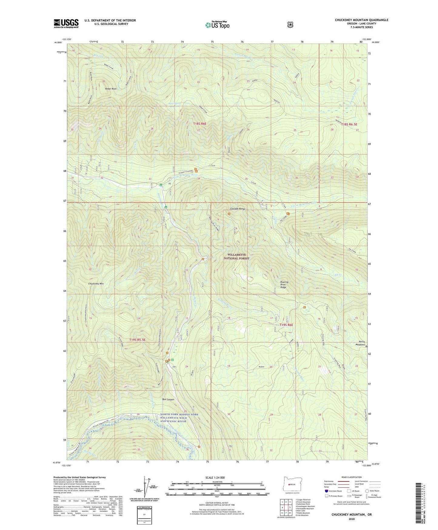
Chucksney Mountain Oregon US Topo Map
Couldn't load pickup availability
Also explore the Chucksney Mountain Forest Service Topo of this same quad for updated USFS data
2023 topographic map quadrangle Chucksney Mountain in the state of Oregon. Scale: 1:24000. Based on the newly updated USGS 7.5' US Topo map series, this map is in the following counties: Lane. The map contains contour data, water features, and other items you are used to seeing on USGS maps, but also has updated roads and other features. This is the next generation of topographic maps. Printed on high-quality waterproof paper with UV fade-resistant inks.
Quads adjacent to this one:
West: Grasshopper Mountain
Northwest: Cougar Reservoir
North: French Mountain
Northeast: Substitute Point
East: Packsaddle Mountain
Southeast: Irish Mountain
South: Waldo Mountain
Southwest: Blair Lake
This map covers the same area as the classic USGS quad with code o43122h1.
Contains the following named places: Beeler Spring, Box Canyon, Box Canyon Horse Camp, Bull Creek, Cascade Creek, Chucksney Creek, Chucksney Mountain, Elk Creek, Fir Creek, Frissell Crossing Campground Boat Ramp, Frissell Crossing Recreation Site, Landis Cabin, McBee Creek, Minute Creek, Moolack Creek, Moss Creek, Rebel Rock, Rebel Rock Lookout, Reilly Meadows, Roaring River, Roaring River Group Camp, Roaring River Ridge, Small Creek, Tiny Creek, Twin Springs Campground, Wapiti Creek