MyTopo
Packsaddle Mountain Oregon US Topo Map
Couldn't load pickup availability
Also explore the Packsaddle Mountain Forest Service Topo of this same quad for updated USFS data
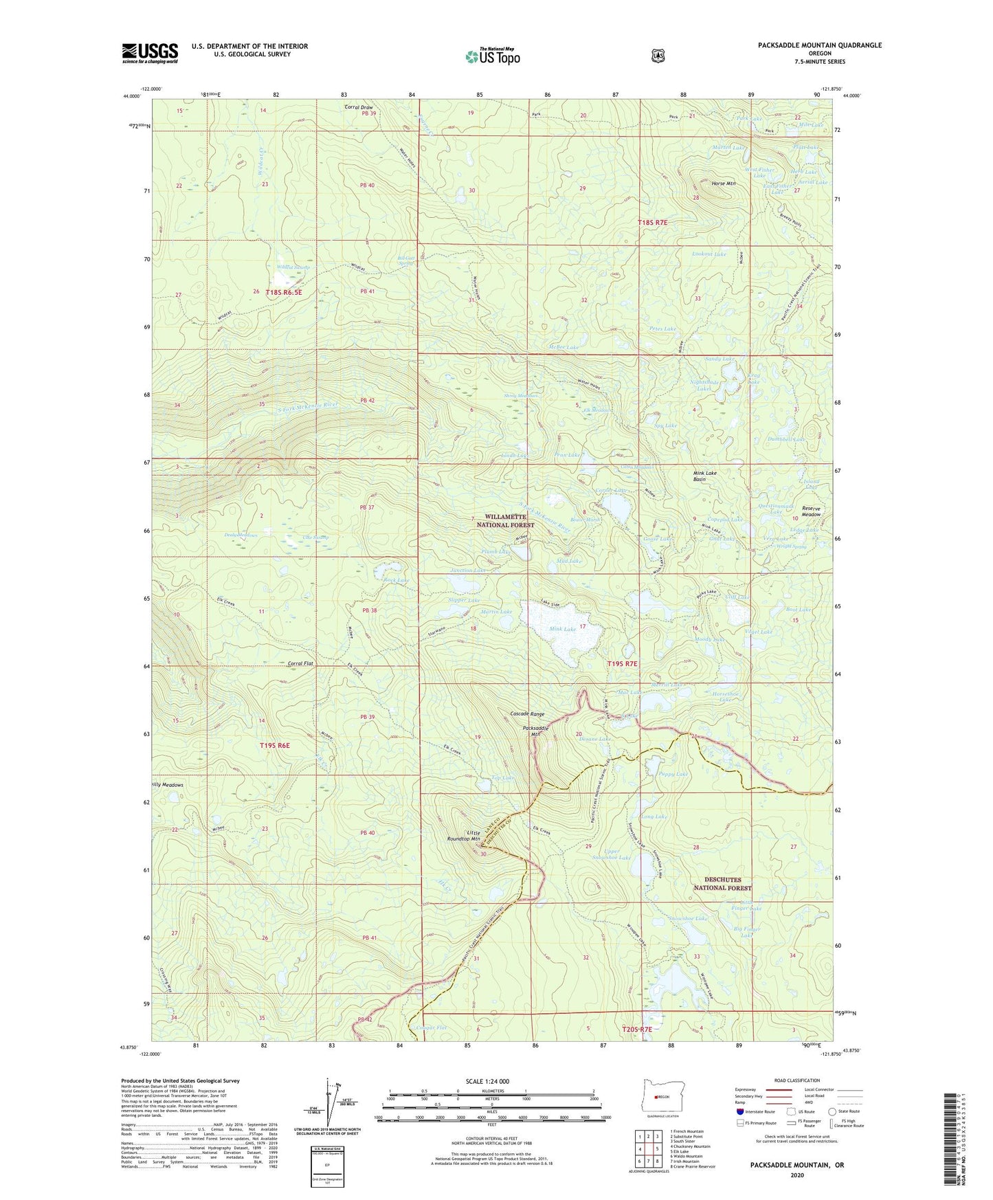
2024 topographic map quadrangle Packsaddle Mountain in the state of Oregon. Scale: 1:24000. Based on the newly updated USGS 7.5' US Topo map series, this map is in the following counties: Lane, Deschutes. The map contains contour data, water features, and other items you are used to seeing on USGS maps, but also has updated roads and other features. This is the next generation of topographic maps. Printed on high-quality waterproof paper with UV fade-resistant inks.
Quads adjacent to this one:
West: Chucksney Mountain
Northwest: French Mountain
North: Substitute Point
Northeast: South Sister
East: Elk Lake
Southeast: Crane Prairie Reservoir
South: Irish Mountain
Southwest: Waldo Mountain
This map covers the same area as the classic USGS quad with code o43121h8.
Contains the following named places: Beaver Marsh, Big Finger Lake, Bill Gott Spring, Boot Lake, Brushy Draw Way, Cabin Meadows, Cliff Lake, Cliff Lake Shelter, Copepod Lake, Corner Lake, Corral Flat, Cougar Flat, Cow Swamp, Dealy Meadows, Dealy Way, Desane Lake, Dumbbell Lake, East Fisher Lake, Elk Creek Trail, Elk Meadows, Gnat Lake, Goose Lake, Goose Lake Trail, Herb Lake, Horse Mountain, Horse Mountain Trail, Horseshoe Lake, Island Lake, Junction Lake, Krag Lake, Lake Way, Lakeside Trail, Ledge Lake, Lindh Lake, Little Finger Lake, Little Roundtop Mountain, Long Lake, Lookout Lake, Mac Lake, Marten Lake, Martin Lake, Martin Way, McBee Lake, McBee Trail, Merrill Lake, Mile Lake, Mink Lake, Mink Lake Basin, Mink Lake Loop Trail, Mink Lake Shelter, Moody Lake, Mud Lake, Mud Lake Cutoff Trail, Mud Lake Trail, Nightshade Lakes, Packsaddle Mountain, Packsaddle Mountain Trail, Park Lake, Park Trail, Penn Lake, Petes Lake, Platt Lake, Plumb Lake, Porky Lake, Puppy Lake, Questionmark Lake, Reserve Meadow, Rock Lake, S Lake, Sandy Lake, Shroy Meadows, Slipper Lake, Snowshoe Lake, Snowshoe Lake Trail, South Fork Way, Spy Lake, Starwano Way, Top Lake, Upper Snowshoe Lake, Vera Lake, Vogel Lake, West Fisher Lake, Wildcat Swamp, Wildcat Trail, Winopee Lake, Wright Spring