MyTopo
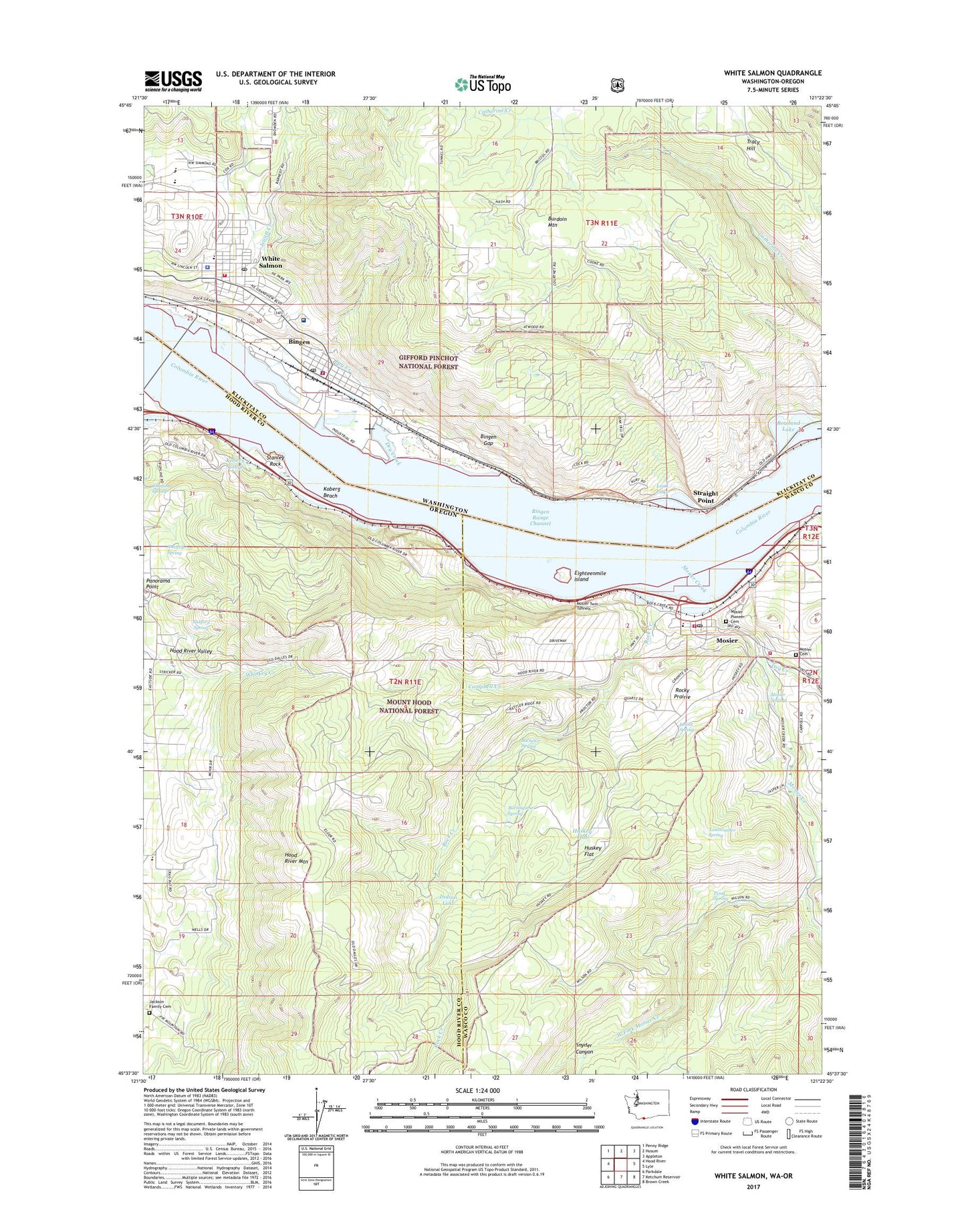
White Salmon Washington US Topo Map
Couldn't load pickup availability
Also explore the White Salmon Forest Service Topo of this same quad for updated USFS data
2023 topographic map quadrangle White Salmon in the states of Oregon, Washington. Scale: 1:24000. Based on the newly updated USGS 7.5' US Topo map series, this map is in the following counties: Klickitat, Hood River, Wasco. The map contains contour data, water features, and other items you are used to seeing on USGS maps, but also has updated roads and other features. This is the next generation of topographic maps. Printed on high-quality waterproof paper with UV fade-resistant inks.
Quads adjacent to this one:
West: Hood River
Northwest: Penny Ridge
North: Husum
Northeast: Appleton
East: Lyle
Southeast: Brown Creek
South: Ketchum Reservoir
Southwest: Parkdale
This map covers the same area as the classic USGS quad with code o45121f4.
Contains the following named places: Bachelor Spring, Bingen, Bingen Fire Department, Bingen Gap, Bingen Police Department, Bingen Post Office, Bingen Range Channel, Bingen Treaty Fishing Access Site, Bristol, Burdoin Mountain, Burlingame Spring, Campbell Creek, City of Bingen, City of Mosier, City of White Salmon, Columbia High School, Department of Motor Vehicles Hood River, Dry Creek, Eighteenmile Island, Guttery Spring, Historic Columbia River Highway State Trail, Hood River Mountain, Hulan L Whitson Elementary School, Huskey Flat, Indian Lake, Jackson Family Cemetery, Jewett Creek, Jewett Creek Park, Johnson Spring, Koberg Beach, Koberg Beach State Park, Koberg Slough, Lelliot Spring, Look Lake, Moore Orchards, Mosier, Mosier Cemetery, Mosier City Hall, Mosier Community School, Mosier Creek, Mosier Pioneer Cemetery, Mosier Post Office, Mosier Rural Fire Department, Mosier Rural Fire District Station 1, Mosier Springs, Mosier Twin Tunnels, Mosier Valley Library, Mosier Volunteer Fire Department, Mosier Wastewater Treatment Plant, Panorama Point, Pine Grove Elementary School, Pioneer Park, Pond Spring, Rock Creek, Rocky Prairie, Rowland Lake, Sanford Spring, Skyline Hospital, Skyline Hospital Ambulance, Snyder Canyon, Stanley Rock, Stanley Rock Treaty Fishing Access Site, Straight Point, Tanawasher Spring, Town and Country Square, Wasco Light, Wayne M Henkle Middle School, West Fork Mosier Creek, White Salmon, White Salmon Elementary School, White Salmon Fire Department, White Salmon Police Department, White Salmon Post Office, White Salmon Treaty Fishing Access Site