MyTopo
Knox Mountain Oregon US Topo Map
Couldn't load pickup availability
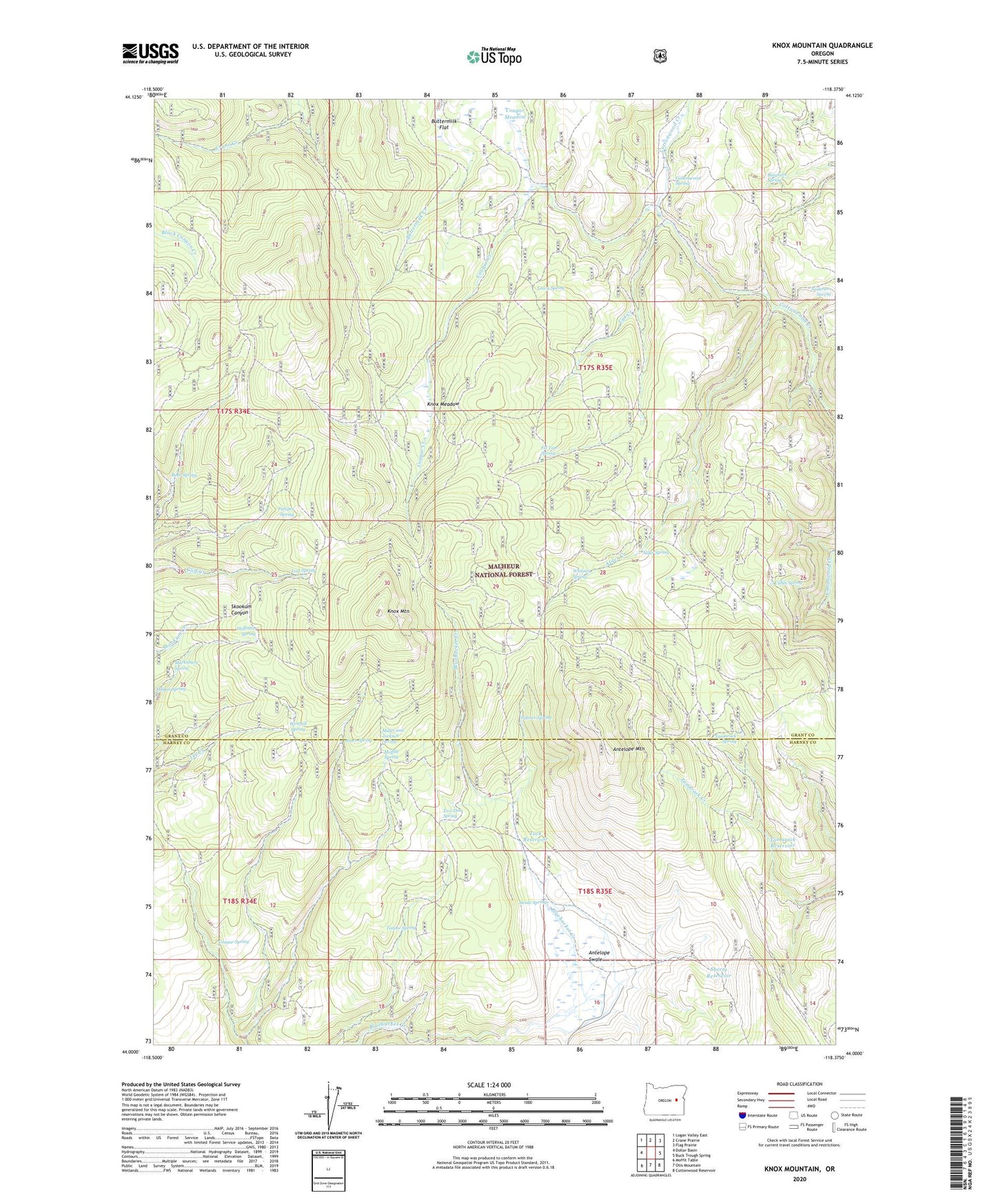
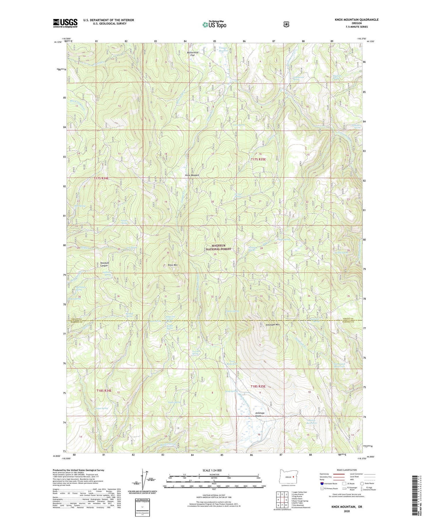
2020 topographic map quadrangle Knox Mountain in the state of Oregon. Scale: 1:24000. Based on the newly updated USGS 7.5' US Topo map series, this map is in the following counties: Grant, Harney. The map contains contour data, water features, and other items you are used to seeing on USGS maps, but also has updated roads and other features. This is the next generation of topographic maps. Printed on high-quality waterproof paper with UV fade-resistant inks.
Quads adjacent to this one:
West: Dollar Basin
Northwest: Logan Valley East
North: Crane Prairie
Northeast: Flag Prairie
East: Buck Trough Spring
Southeast: Cottonwood Reservoir
South: Otis Mountain
Southwest: Moffit Table
Contains the following named places: Alder Creek, Alder Spring, Antelope Lookout Tower, Antelope Mountain, Antelope Swale, Bear Spring, Bingham Spring, Blue Bucket Cow Camp, Buttermilk Flat, Cabin Spring, Cat Creek, Cottonwood Spring, Cougar Creek, Cougar Meadow, Cougar Spring, Fir Tree Spring, Hoffman Spring, Hogan Spring, Jones Spring, Juniper Spring, Knox Meadow, Knox Mountain, Leacy Spring, Lost Spring, Marksbury Spring, Miller and Jackson Spring, Moffitt Spring, North Alder Spring, Ott Cow Camp, Palmer Spring, Shorty Reservoir, Swale Springs, Tamarack Reservoir, Tamarack Spring, Teepee Spring, Tuck Reservoir, Two Dot Spring, Westfall Spring, Whitney Spring