MyTopo
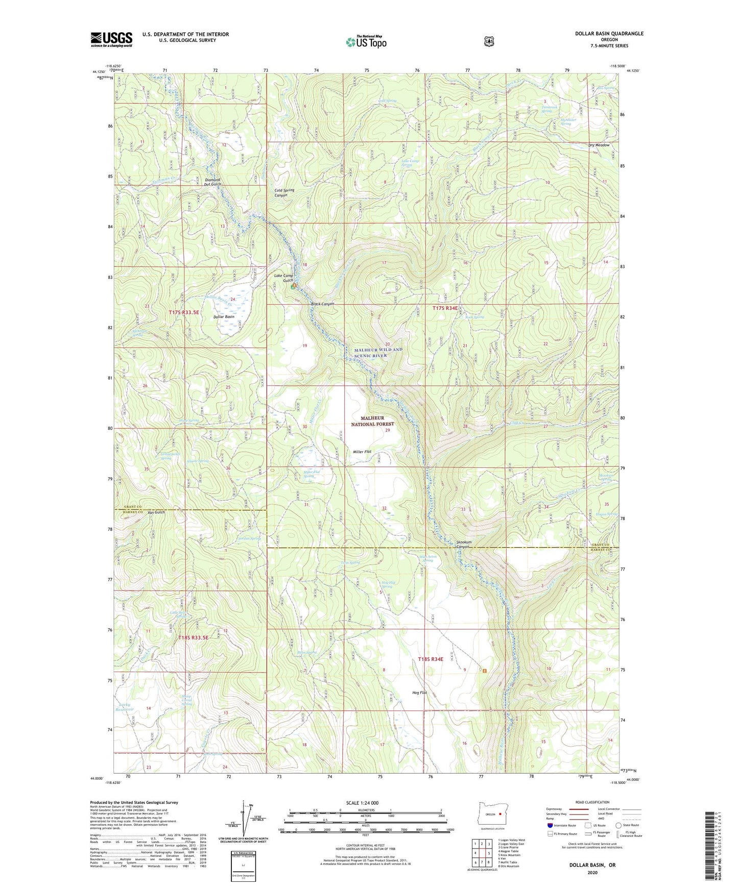
Dollar Basin Oregon US Topo Map
Couldn't load pickup availability
Also explore the Dollar Basin Forest Service Topo of this same quad for updated USFS data
2024 topographic map quadrangle Dollar Basin in the state of Oregon. Scale: 1:24000. Based on the newly updated USGS 7.5' US Topo map series, this map is in the following counties: Grant, Harney. The map contains contour data, water features, and other items you are used to seeing on USGS maps, but also has updated roads and other features. This is the next generation of topographic maps. Printed on high-quality waterproof paper with UV fade-resistant inks.
Quads adjacent to this one:
West: Magpie Table
Northwest: Logan Valley West
North: Logan Valley East
Northeast: Crane Prairie
East: Knox Mountain
Southeast: Otis Mountain
South: Moffit Table
Southwest: Van
This map covers the same area as the classic USGS quad with code o44118a5.
Contains the following named places: Altnow Spring, Black Canyon, Black Canyon Creek, Blinn Spring, Box Spring, Cliff Creek, Cold Spring, Cold Spring Canyon, Diamond Dot Gulch, Dollar Basin, Dollar Basin Creek, Dry Meadow, Hawk Spring, Hog Flat, Hog Flat Spring, Jordan Spring, Lake Camp Gulch, Lake Camp Spring, Lee Creek, Little Bear Spring, Malheur Ford, Malheur Ford Camp, Malheur River Trailhead, Malheur Wild and Scenic River, McAllister Spring, McArthur Spring, Mike Acton Spring, Miller Flat, Miller Flat Creek, Miller Flat Spring, Rock Spring, Sheep Corral Spring, Skookum Canyon, Skookum Creek, Skookum Spring, Summit Creek, Tamarack Camp, Tamarack Spring, Tureman Creek, Twin Spring, Wade Spring, Yellowjacket Spring