MyTopo
La Grande Oregon US Topo Map
Couldn't load pickup availability
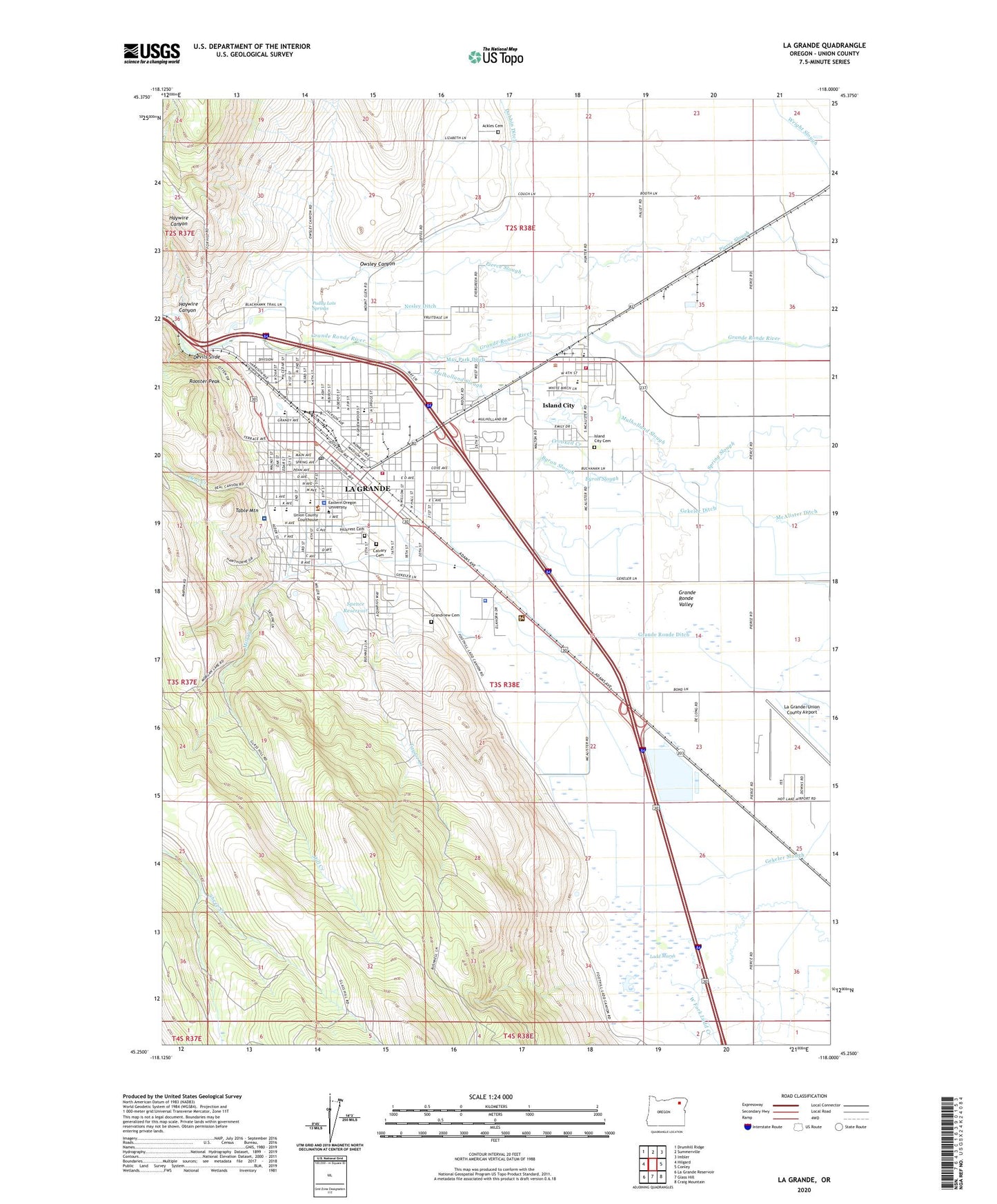
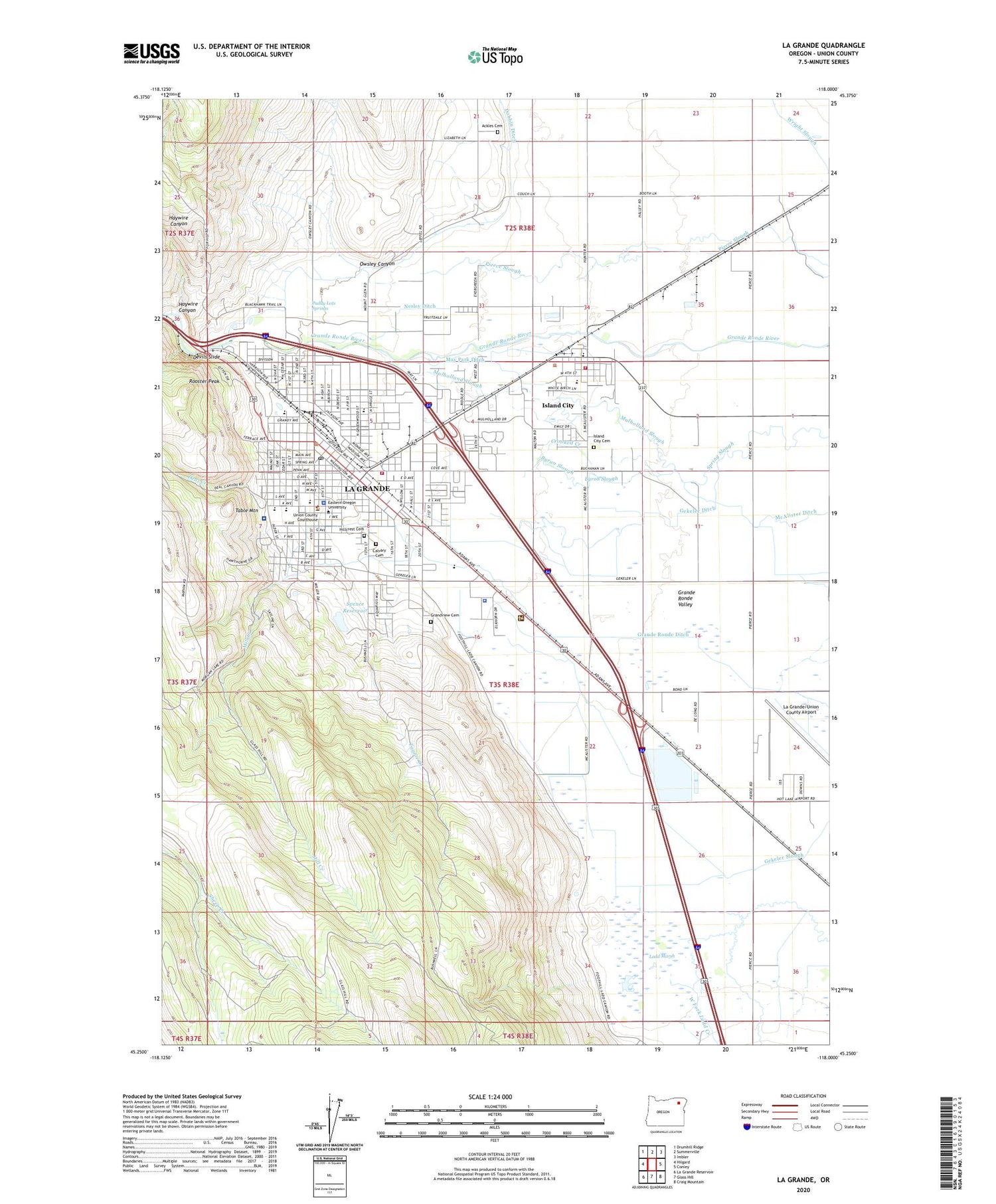
2020 topographic map quadrangle La Grande in the state of Oregon. Scale: 1:24000. Based on the newly updated USGS 7.5' US Topo map series, this map is in the following counties: Union. The map contains contour data, water features, and other items you are used to seeing on USGS maps, but also has updated roads and other features. This is the next generation of topographic maps. Printed on high-quality waterproof paper with UV fade-resistant inks.
Quads adjacent to this one:
West: Hilgard
Northwest: Drumhill Ridge
North: Summerville
Northeast: Imbler
East: Conley
Southeast: Craig Mountain
South: Glass Hill
Southwest: La Grande Reservoir
Contains the following named places: Ackles Cemetery, Air Life of Oregon, American Red Cross Northeast Oregon District La Grade Office, Baum, Benton Park, Booth Lane, Byron Reservoir, Byron Slough, Calvary Cemetery, Candy Cane Park, Central Elementary School, City of Island City, City of La Grande, Crooked Creek, Deal Creek, Department of Motor Vehicles La Grande, Devils Slide, Dobbin Ditch, Eastern Oregon Fire Museum and Learning Center, Eastern Oregon University, Eastern Oregon University Community Stadium, Eastern Oregon University McKenzie Theatre, F Maxine and Thomas W Cook Memorial Library, Gangloff Park, Garden Club Park, Gekeler Ditch, George Birnie Memorial Park, Grande Ronde Academy, Grande Ronde Ditch, Grande Ronde Hospital, Grandview Cemetery, Greenwood Elementary School, Greyhound Station La Grande, Haywire Canyon, Hillcrest Cemetery, Island City, Island City - City Hall, Island City Cemetery, Island City Elementary School, Island City Post Office, Island City Public Works, KEOL-FM, KLBM-AM, KLBM-FM, La Grande, La Grande Adventist School, La Grande City Hall, La Grande Country Club, La Grande Division, La Grande Fire Department, La Grande High School, La Grande Middle School, La Grande Municipal Court, La Grande Police Department, La Grande Post Office, La Grande Public Works Department, La Grande Ranger District, La Grande Rural Fire Protection District, La Grande Speedway, La Grande Wastewater Treatment Plant, La Grande/Union County Airport, Ladd Marsh, Ladd Marsh Game Management Area, Lone Tree, May Park Ditch, Mill Creek, Mulholland Slough, Nesley Ditch, Northeast Oregon Transit La Grande Transit Hub Bus Station, Oregon State Police Department - LaGrande Area Command, Orodell, Orodell Post Office, Owsley Canyon, Paddy Lots Springs, Pierce Spur, Pioneer Park, Rambling Rotors Heliport, Riveria School, Riverside Park, Rooster Peak, Spence Reservoir, Sunnyhill Park, Table Mountain, Taylor Creek, Union County, Union County Center for Human Development Office, Union County Circuit Court, Union County Fairgrounds, Union County Public Works, Union County Sheriff's Office, Willow Elementary School, ZIP Code: 97850