MyTopo
Brady Butte Oregon US Topo Map
Couldn't load pickup availability
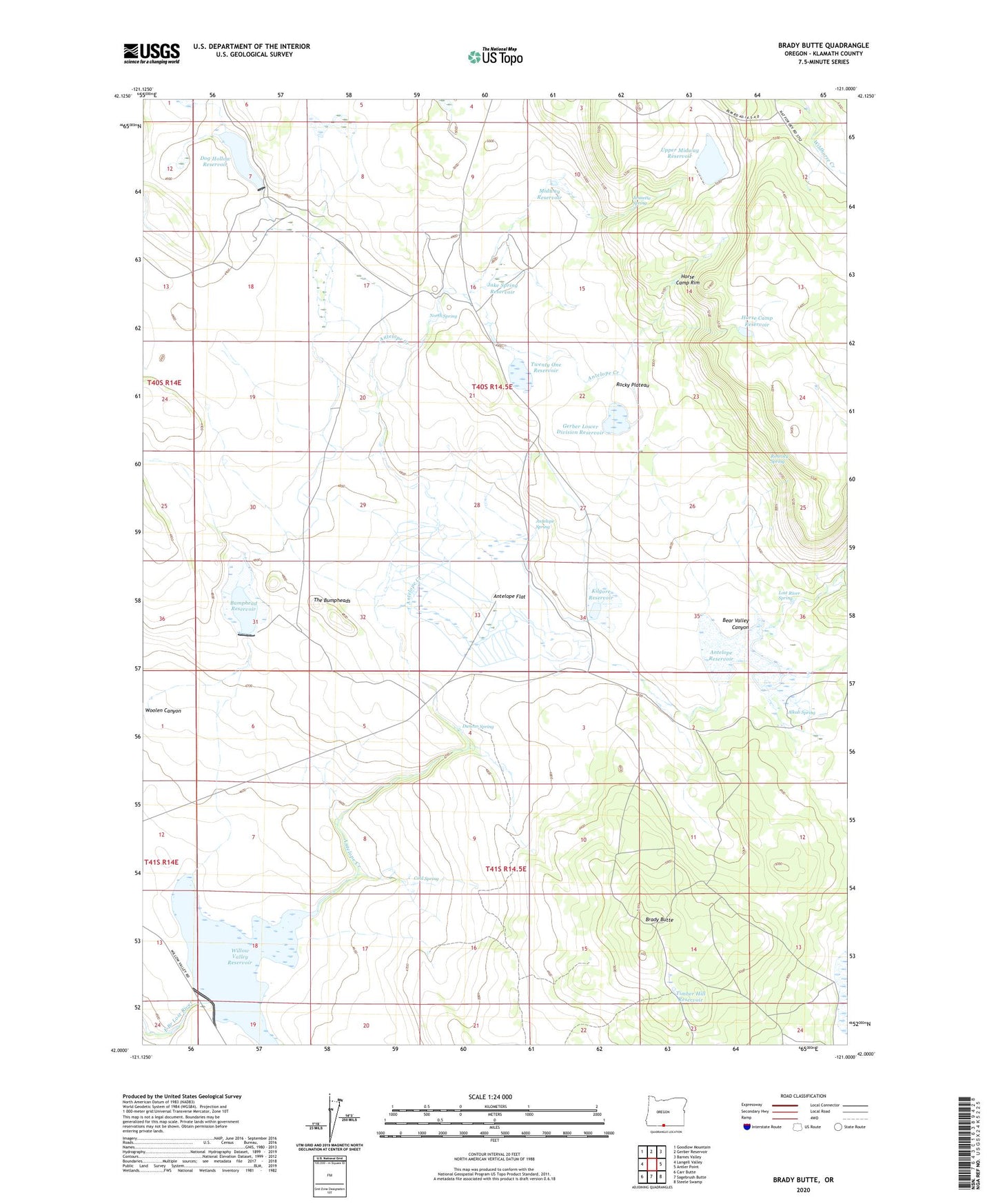
2023 topographic map quadrangle Brady Butte in the state of Oregon. Scale: 1:24000. Based on the newly updated USGS 7.5' US Topo map series, this map is in the following counties: Klamath. The map contains contour data, water features, and other items you are used to seeing on USGS maps, but also has updated roads and other features. This is the next generation of topographic maps. Printed on high-quality waterproof paper with UV fade-resistant inks.
Quads adjacent to this one:
West: Langell Valley
Northwest: Goodlow Mountain
North: Gerber Reservoir
Northeast: Barnes Valley
East: Antler Point
Southeast: Steele Swamp
South: Sagebrush Butte
Southwest: Carr Butte
This map covers the same area as the classic USGS quad with code o42121a1.
Contains the following named places: Alkali Spring, Antelope Creek, Antelope Dam, Antelope Flat, Antelope Ranch, Antelope Reservoir, Antelope Reservoir Day-Use Area, Antelope Spring, Bear Valley Canyon, Brady Butte, Bumphead Dam, Bumphead Reservoir, Cold Spring, Dog Hollow Dam, Dog Hollow Reservoir, Duncan Spring, Gerber Lower Division Reservoir, Horse Camp Reservoir, Horse Camp Rim, Jake Spring Reservoir, Jennette Spring, Junction Waterhole, Kilgore Dam, Kilgore Reservoir, Logger Waterhole, Lost River Spring, Midway Reservoir, North Spring, Rimrock Spring, Rocky Plateau, Spreader Reservoir, The Bumpheads, Timber Hill Reservoir, Twenty One Reservoir, Upper Midway Dam, Upper Midway Reservoir, Willow Valley Boat Ramp, Willow Valley Campground, Willow Valley Dam, Willow Valley Reservoir