MyTopo
Mill City South Oregon US Topo Map
Couldn't load pickup availability
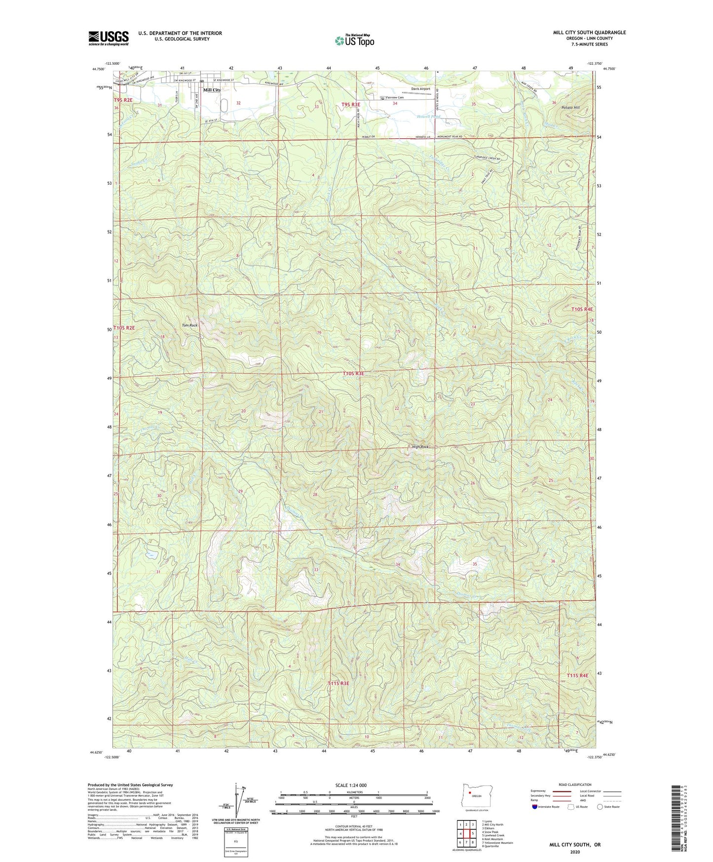
2023 topographic map quadrangle Mill City South in the state of Oregon. Scale: 1:24000. Based on the newly updated USGS 7.5' US Topo map series, this map is in the following counties: Linn. The map contains contour data, water features, and other items you are used to seeing on USGS maps, but also has updated roads and other features. This is the next generation of topographic maps. Printed on high-quality waterproof paper with UV fade-resistant inks.
Quads adjacent to this one:
West: Snow Peak
Northwest: Lyons
North: Mill City North
Northeast: Elkhorn
East: Lawhead Creek
Southeast: Quartzville
South: Yellowstone Mountain
Southwest: Keel Mountain
This map covers the same area as the classic USGS quad with code o44122f4.
Contains the following named places: Camp Twenty-six, Cougar Camp, Davis Airport, Davis Airport Terminal, DeFord Creek, East Rock Creek, Fairview Cemetery, Gates Elementary School, Gates Guard Station, Hall Creek, High Rock, Howell Pond, Little Rock Creek, Mill City Division, Mill City Post Office, Potato Hill, Santiam State Forest, Snake Creek, Tom Rock