MyTopo
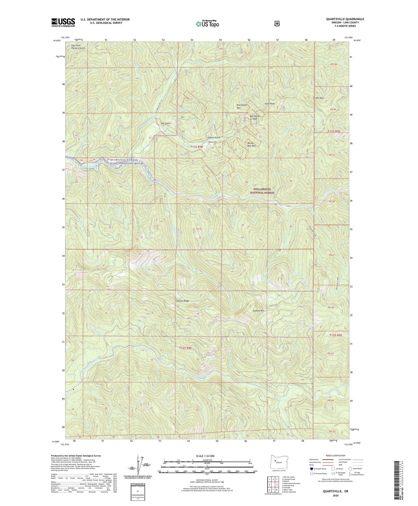
Quartzville Oregon US Topo Map
Couldn't load pickup availability
Also explore the Quartzville Forest Service Topo of this same quad for updated USFS data
2023 topographic map quadrangle Quartzville in the state of Oregon. Scale: 1:24000. Based on the newly updated USGS 7.5' US Topo map series, this map is in the following counties: Linn. The map contains contour data, water features, and other items you are used to seeing on USGS maps, but also has updated roads and other features. This is the next generation of topographic maps. Printed on high-quality waterproof paper with UV fade-resistant inks.
Quads adjacent to this one:
West: Yellowstone Mountain
Northwest: Mill City South
North: Lawhead Creek
Northeast: Detroit
East: Chimney Peak
Southeast: Harter Mountain
South: Upper Soda
Southwest: Cascadia
This map covers the same area as the classic USGS quad with code o44122e3.
Contains the following named places: Albany Mine, Bear Creek, Beverly Creek, Bryant City, Canal Creek, Cedar Creek, Crash Creek, Dry Gulch, Edison Creek, Edison Gulch, Elk Creek, Galena Creek, Galena Mountain, Galena Ridge, Gold Creek, Gold Peak, Green Creek, Green Mountain, Gregg Creek, Lone Star, Maple Creek, McQuade Creek, Minniece Point Trail, Quartzville, Quartzville Guard Station, Red Heifer Mountain, Red Heifer Pass, Savage Creek, Silver Creek, Sixes Creek, Twin Falls Creek, West Fork McQuade Creek, White Bull Mountain, Yellowbottom Creek, Yellowbottom Recreation Site