MyTopo
Little Juniper Spring Oregon US Topo Map
Couldn't load pickup availability
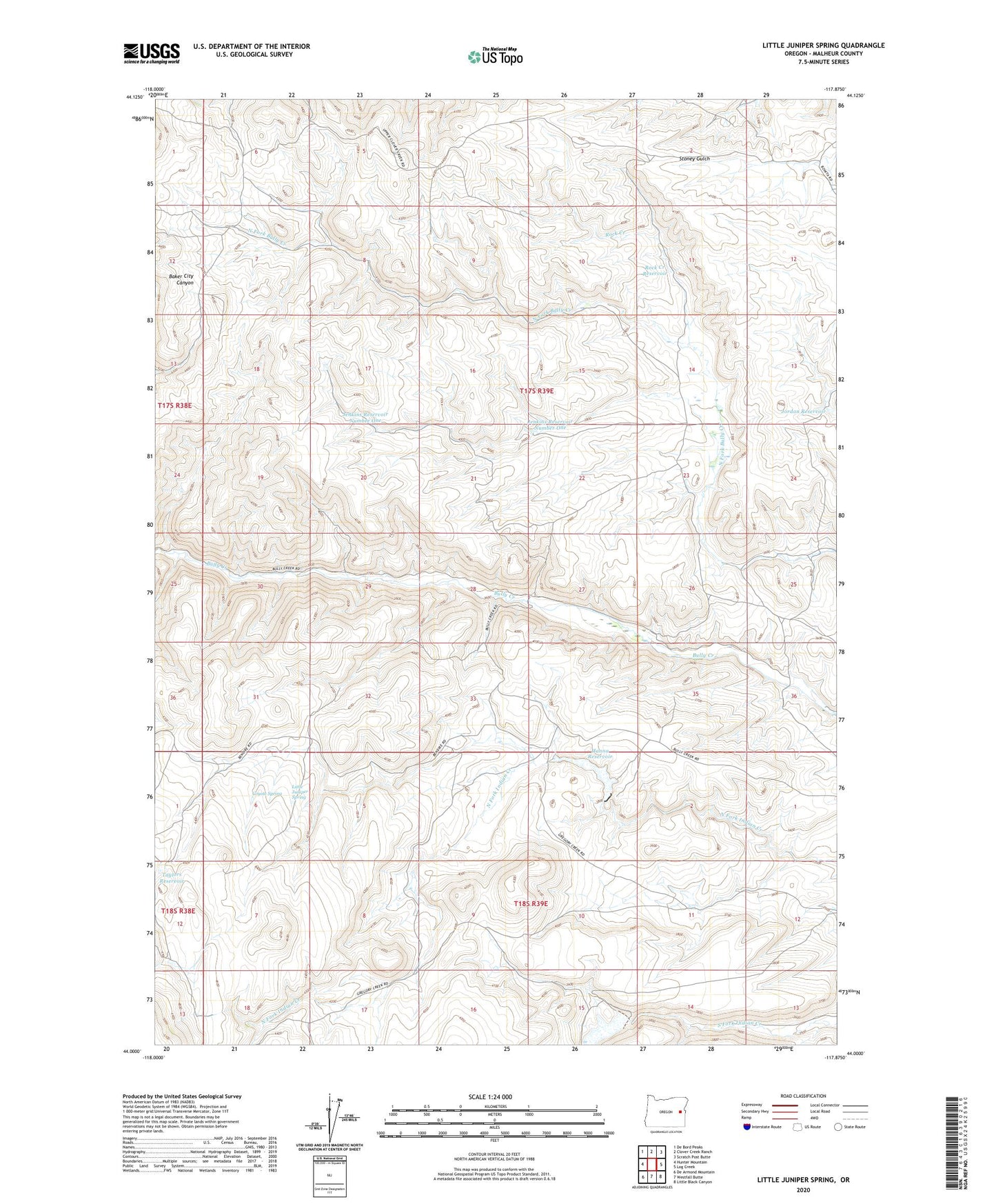
2023 topographic map quadrangle Little Juniper Spring in the state of Oregon. Scale: 1:24000. Based on the newly updated USGS 7.5' US Topo map series, this map is in the following counties: Malheur. The map contains contour data, water features, and other items you are used to seeing on USGS maps, but also has updated roads and other features. This is the next generation of topographic maps. Printed on high-quality waterproof paper with UV fade-resistant inks.
Quads adjacent to this one:
West: Hunter Mountain
Northwest: De Bord Peaks
North: Clover Creek Ranch
Northeast: Scratch Post Butte
East: Log Creek
Southeast: Little Black Canyon
South: Westfall Butte
Southwest: De Armond Mountain
This map covers the same area as the classic USGS quad with code o44117a8.
Contains the following named places: Coyote Spring, Hanna Ranch, Hanna Reservoir, Jenkins Ranch, Jenkins Reservoir Number One, Jordan Reservoir, Little Juniper Spring, North Fork Indian Creek Dam, P Hart Ranch, Rock Creek, Rock Creek Reservoir, Taylors Reservoir, Vaughn Dam, Zotto Reservoir