MyTopo
De Armond Mountain Oregon US Topo Map
Couldn't load pickup availability
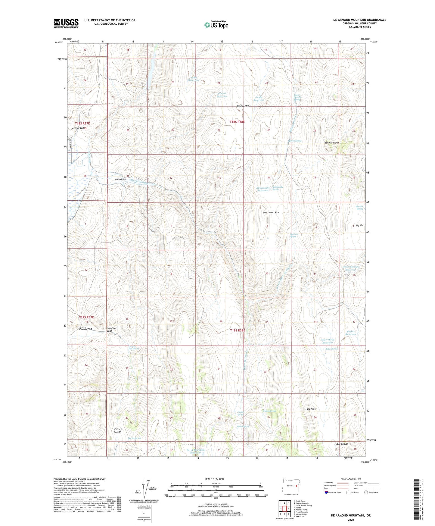
2024 topographic map quadrangle De Armond Mountain in the state of Oregon. Scale: 1:24000. Based on the newly updated USGS 7.5' US Topo map series, this map is in the following counties: Malheur. The map contains contour data, water features, and other items you are used to seeing on USGS maps, but also has updated roads and other features. This is the next generation of topographic maps. Printed on high-quality waterproof paper with UV fade-resistant inks.
Quads adjacent to this one:
West: Beulah
Northwest: Castle Rock
North: Hunter Mountain
Northeast: Little Juniper Spring
East: Westfall Butte
Southeast: Jonesboro
South: Stemler Ridge
Southwest: Petes Mountain
This map covers the same area as the classic USGS quad with code o43118h1.
Contains the following named places: Angel Wells Reservoir, Baker Spring, Barrel Spring, Becker Reservoir, Bendire Creek, Bendire Mountain, Bendire Ridge, Big Flat, Big Flat Spring, Burnt Mountain Reservoir, De Armond Mountain, Goldy Reservoir, Indian Spring, Juniper Reservoir, Juniper Spring, Lower Morton Spring, Morton Spring, Munkers Ranch, Munkers Spring, Murphy Dam, Murphy Reservoir, North Fork Warm Springs Creek, Pole Gulch, Poverty Flat, Poverty Flat Spring, Rattlesnake Reservoir, Rattlesnake Spring, Rodeo Spring, Slaughter Gulch, Table Reservoir, Warm Springs Reservoir