MyTopo
Hunter Mountain Oregon US Topo Map
Couldn't load pickup availability
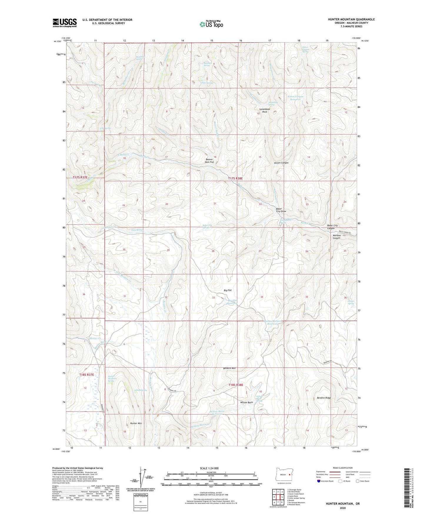
2024 topographic map quadrangle Hunter Mountain in the state of Oregon. Scale: 1:24000. Based on the newly updated USGS 7.5' US Topo map series, this map is in the following counties: Malheur. The map contains contour data, water features, and other items you are used to seeing on USGS maps, but also has updated roads and other features. This is the next generation of topographic maps. Printed on high-quality waterproof paper with UV fade-resistant inks.
Quads adjacent to this one:
West: Castle Rock
Northwest: Clevenger Butte
North: De Bord Peaks
Northeast: Clover Creek Ranch
East: Little Juniper Spring
Southeast: Westfall Butte
South: De Armond Mountain
Southwest: Beulah
This map covers the same area as the classic USGS quad with code o44118a1.
Contains the following named places: Baker City Canyon, Baker City Draw, Baker City Springs, Beaver Dam Creek, Beaver Dam Flat, Big Flat, Big Flat Reservoir, Buckskin Spring, Cold Spring, Earp Spring, Godding Creek, Hunter Creek, Hunter Ditch, Hunter Mountain, Hunter Mountain Spring, Hunter Ranch, Juniper Spring, Kitten Canyon, Kitten Canyon Reservoir, Kitten Canyon Spring, Mailbox Canyon, Mailbox Canyon Reservoir, McArthur Creek, McArthur Spring, North Bully Creek, Pinto Springs, Puckett Creek, Schoolmarm Spring, South Bully Creek, Steamboat Creek, Steamboat Rock, Steamboat Spring, West Fork Bendire Creek, Willow Basin, Willow Basin Creek, Willow Basin Reservoir, Willow Basin Spring, Wilson Spring