MyTopo
Devils Graveyard Oregon US Topo Map
Couldn't load pickup availability
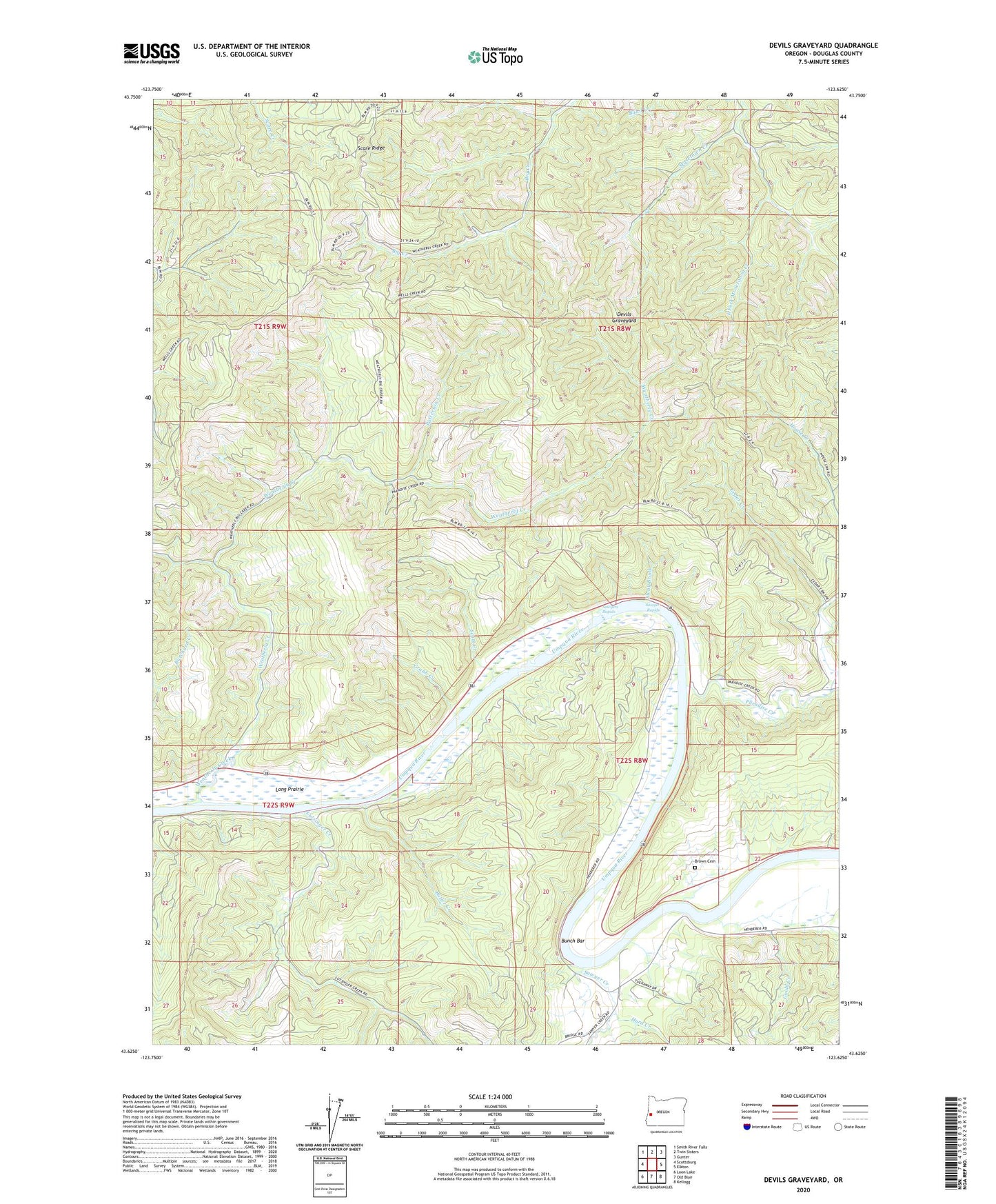
2024 topographic map quadrangle Devils Graveyard in the state of Oregon. Scale: 1:24000. Based on the newly updated USGS 7.5' US Topo map series, this map is in the following counties: Douglas. The map contains contour data, water features, and other items you are used to seeing on USGS maps, but also has updated roads and other features. This is the next generation of topographic maps. Printed on high-quality waterproof paper with UV fade-resistant inks.
Quads adjacent to this one:
West: Scottsburg
Northwest: Smith River Falls
North: Twin Sisters
Northeast: Gunter
East: Elkton
Southeast: Kellogg
South: Old Blue
Southwest: Loon Lake
This map covers the same area as the classic USGS quad with code o43123f6.
Contains the following named places: Brown Cemetery, Bunch Bar, Bunch Bar Wayside, Butler Creek, Cedar Creek, Devils Graveyard, East Fork Mosetown Creek, Gould Creek, Grabb Creek, Hurd Creek, Little Paradise Creek, Little Stony Brook Creek, Long Prairie, Lutsinger Creek, Paradise Creek, Patterson Creek, Sawyer Creek, Sawyer Rapids, Sawyers Ferry, Sawyers Rapids, Sawyers Rapids County Park Boat Ramp, Scare Ridge, Scott Creek, Scott Creek County Park, Scott Creek County Park Boat Ramp, Stony Brook, Umpqua Myrtle State Park, Weatherly Creek