MyTopo
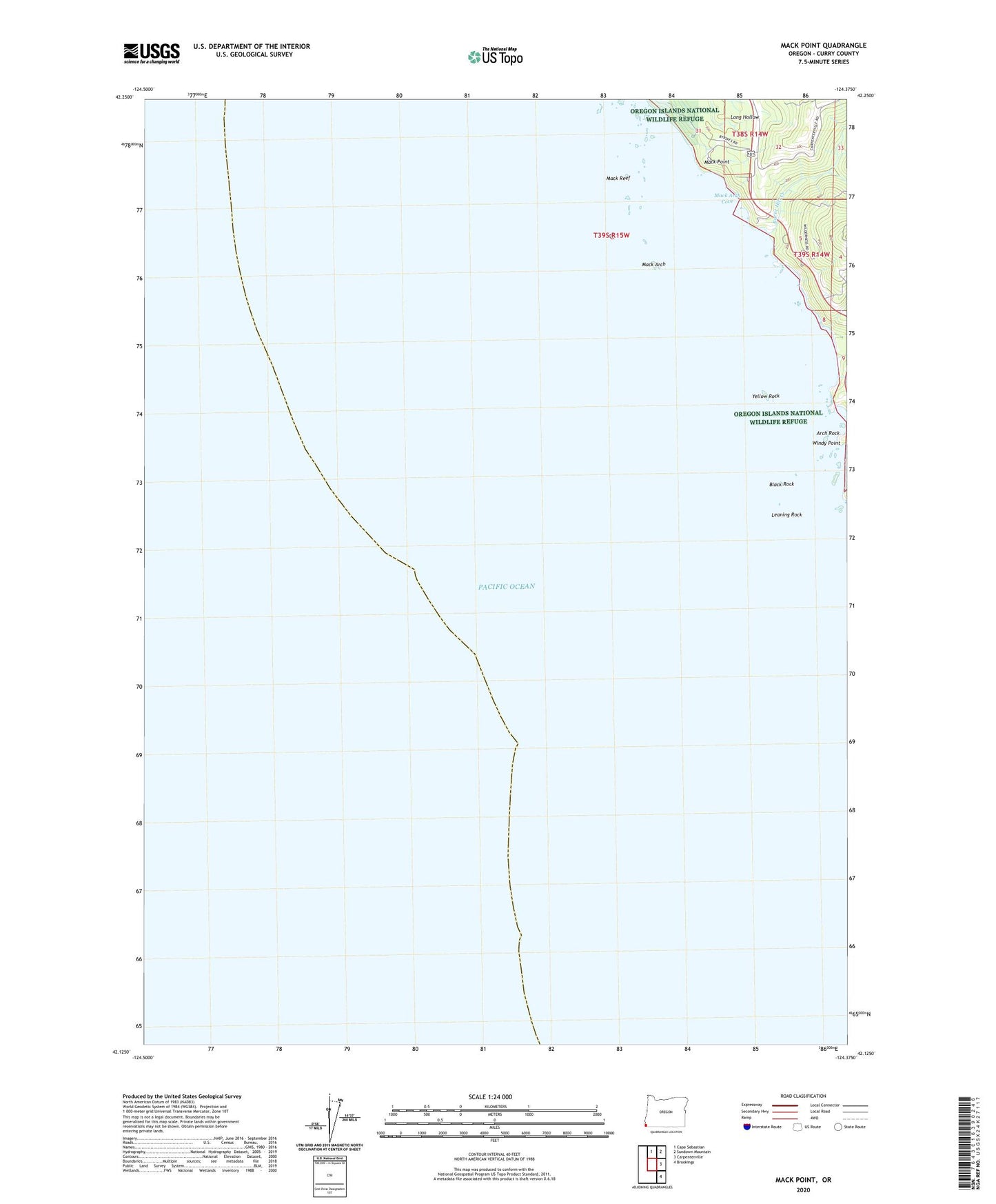
Mack Point Oregon US Topo Map
Couldn't load pickup availability
Also explore the Mack Point Forest Service Topo of this same quad for updated USFS data
2024 topographic map quadrangle Mack Point in the state of Oregon. Scale: 1:24000. Based on the newly updated USGS 7.5' US Topo map series, this map is in the following counties: Curry. The map contains contour data, water features, and other items you are used to seeing on USGS maps, but also has updated roads and other features. This is the next generation of topographic maps. Printed on high-quality waterproof paper with UV fade-resistant inks.
Quads adjacent to this one:
North: Cape Sebastian
Northeast: Sundown Mountain
East: Carpenterville
Southeast: Brookings
This map covers the same area as the classic USGS quad with code o42124b4.
Contains the following named places: Arch Rock, Black Rock, Burnt Hill Creek, Hooskanaden Creek, Leaning Rock, Mack Arch, Mack Arch Cove, Mack Point, Mack Reef, Oregon Islands National Wildlife Refuge, Whiskey Creek, Windy Point, Yellow Rock