MyTopo
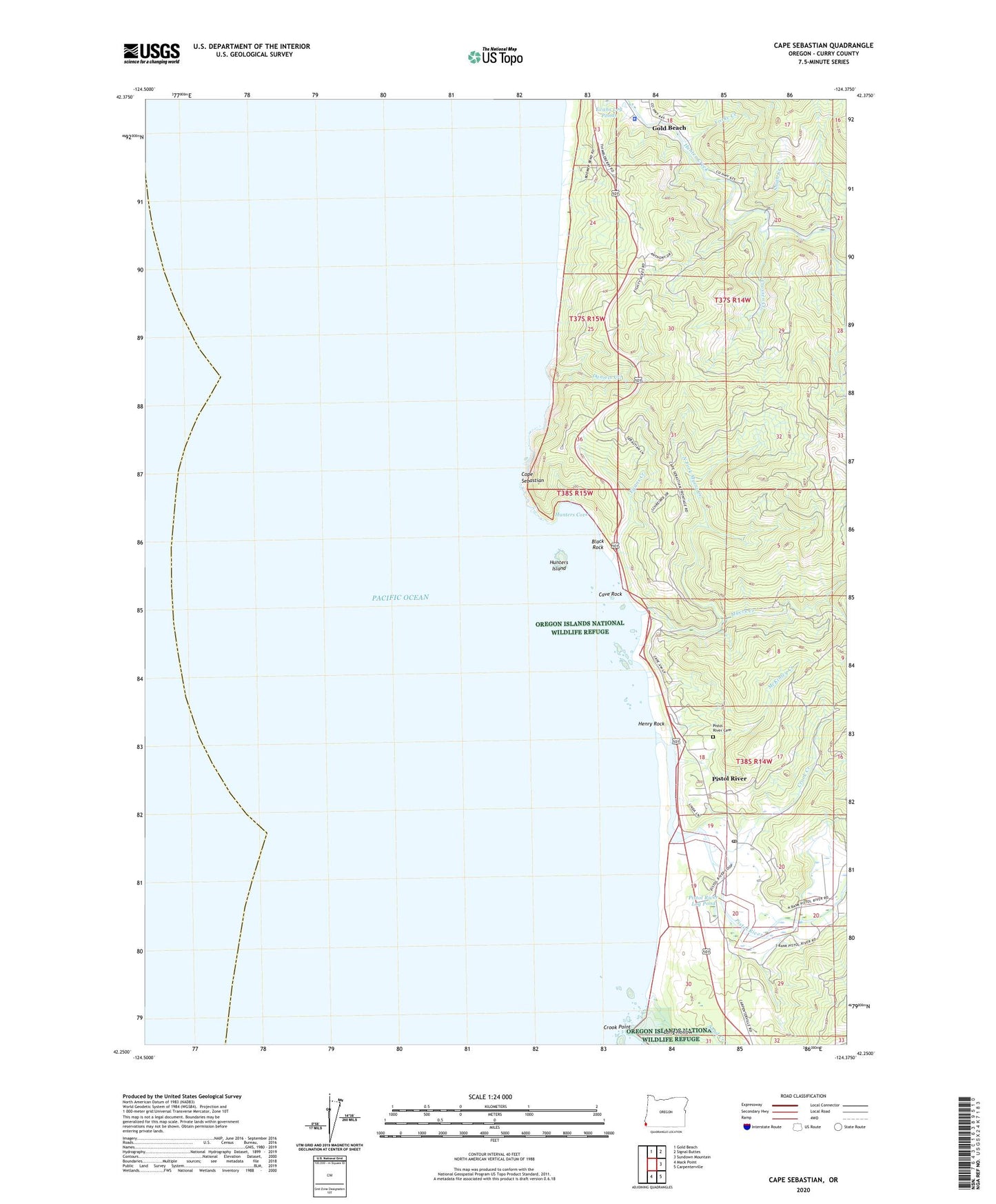
Cape Sebastian Oregon US Topo Map
Couldn't load pickup availability
Also explore the Cape Sebastian Forest Service Topo of this same quad for updated USFS data
2024 topographic map quadrangle Cape Sebastian in the state of Oregon. Scale: 1:24000. Based on the newly updated USGS 7.5' US Topo map series, this map is in the following counties: Curry. The map contains contour data, water features, and other items you are used to seeing on USGS maps, but also has updated roads and other features. This is the next generation of topographic maps. Printed on high-quality waterproof paper with UV fade-resistant inks.
Quads adjacent to this one:
North: Gold Beach
Northeast: Signal Buttes
East: Sundown Mountain
Southeast: Carpenterville
South: Mack Point
This map covers the same area as the classic USGS quad with code o42124c4.
Contains the following named places: Black Rock, Cape Sebastian, Cape Sebastian State Park, Cave Rock, Crook Creek, Crook Point, Crossen Creek, Curry County Public Works, Daniels Creek, Egans Creek, Evans Log Ponds, Henry Rock, Hidden Creek, Hunters Cove, Hunters Island, Long Hollow, McKinley Creek, Myers Creek, North Fork Myers Creek, Oregon State Police Department Gold Beach Worksite, Pistol River, Pistol River Cemetery, Pistol River Census Designated Place, Pistol River Log Pond, Pistol River Post Office, Pistol River Rural Fire Protection District, Pistol River State Park, Saddle Rock, Sand Creek, Smith Creek, Taylor Creek, Yorke Creek