MyTopo
Warm Springs Butte Oregon US Topo Map
Couldn't load pickup availability
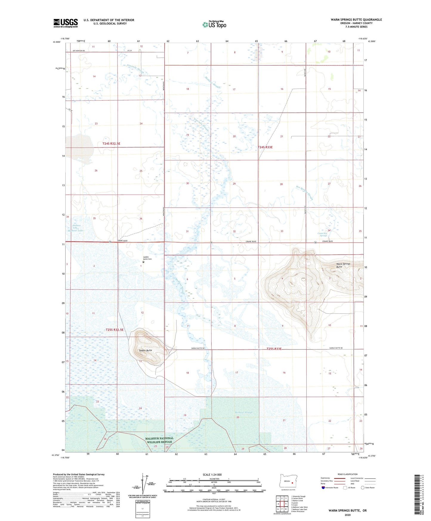
2024 topographic map quadrangle Warm Springs Butte in the state of Oregon. Scale: 1:24000. Based on the newly updated USGS 7.5' US Topo map series, this map is in the following counties: Harney. The map contains contour data, water features, and other items you are used to seeing on USGS maps, but also has updated roads and other features. This is the next generation of topographic maps. Printed on high-quality waterproof paper with UV fade-resistant inks.
Quads adjacent to this one:
West: Lawen
Northwest: Ninemile Slough
North: Carson Point
Northeast: Mahon Creek
East: Crane
Southeast: New Princeton
South: Malheur Lake East
Southwest: Malheur Lake West
This map covers the same area as the classic USGS quad with code o43118d6.
Contains the following named places: Albritton, Crane Hot Springs, Crowcamp Creek, Del Norte Post Office, Harriman Post Office, Hot Springs Slough, Howell Lake, Malheur Slough, Ninemile Slough, Saddle Butte, Saddle Butte Cemetery, Saddlebutte Post Office, Warm Springs Butte