MyTopo
Matlock Prairie Oregon US Topo Map
Couldn't load pickup availability
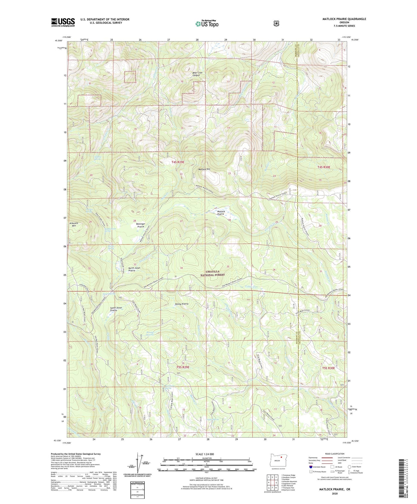
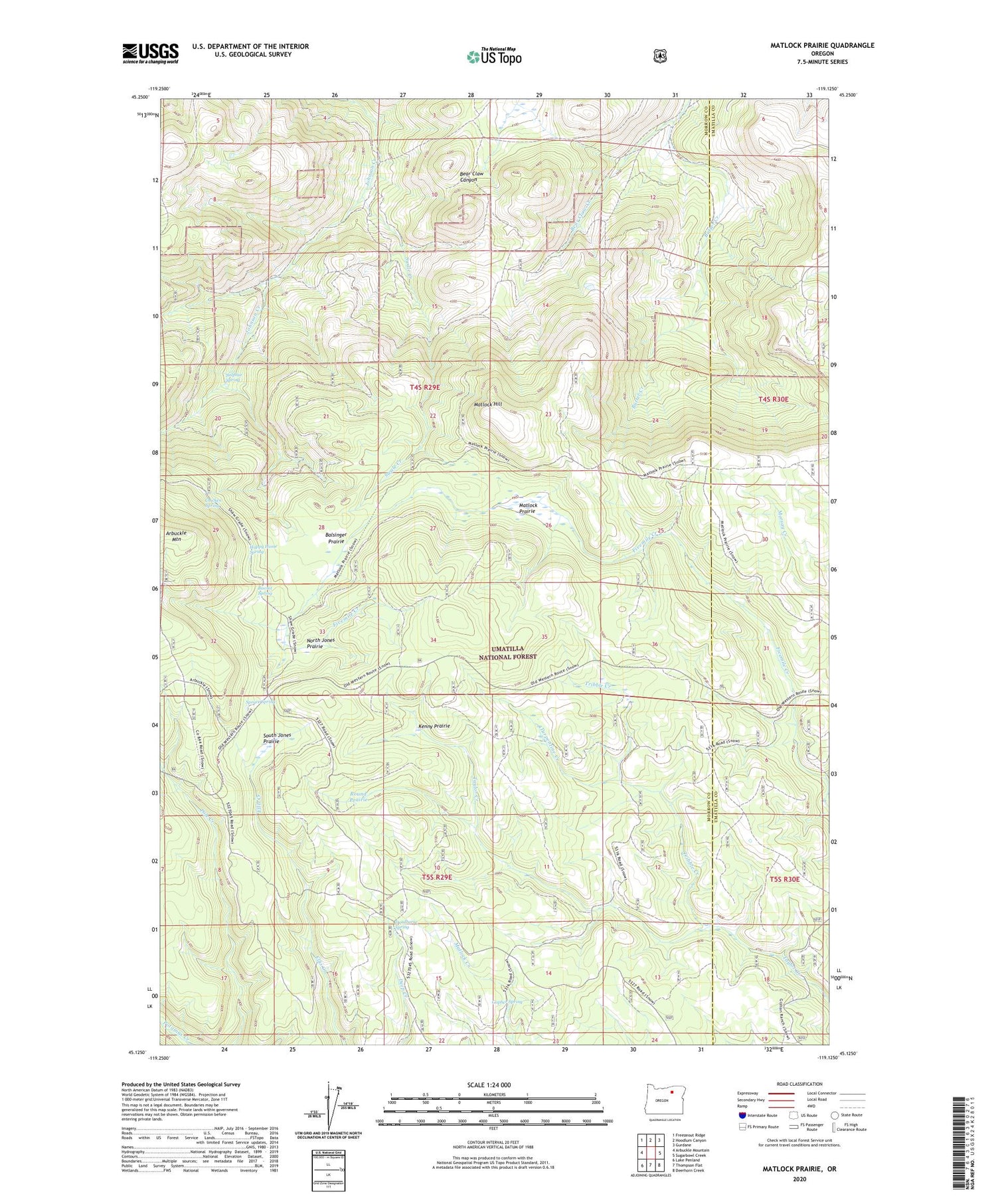
2020 topographic map quadrangle Matlock Prairie in the state of Oregon. Scale: 1:24000. Based on the newly updated USGS 7.5' US Topo map series, this map is in the following counties: Morrow, Umatilla. The map contains contour data, water features, and other items you are used to seeing on USGS maps, but also has updated roads and other features. This is the next generation of topographic maps. Printed on high-quality waterproof paper with UV fade-resistant inks.
Quads adjacent to this one:
West: Arbuckle Mountain
Northwest: Freezeout Ridge
North: Hoodlum Canyon
Northeast: Gurdane
East: Sugarbowl Creek
Southeast: Deerhorn Creek
South: Thompson Flat
Southwest: Lake Penland
Contains the following named places: Arbuckle Ski Area, Balsinger Prairie, Bear Claw Creek, Biscuit Spring, Chicken Spring, Deadhorse Spring, Ellis Forest Service Station, Fivemile Cow Camp, Four Corners, Freezeout Trail, Gopher Spring, Happy Home Spring, Kenny Prairie, Matlock Hill, Matlock Prairie, North Jones Prairie, North Jones Trail, Pole Creek Trail, Round Prairie, South Jones Prairie, Spruce Spring, Sulphur Spring, Swale Creek, Tribble Creek, Turpentine Creek